
Every organization we link to: local tourism offices, the state and federal agencies that manage the land, the nonprofits and clubs that keep access open, and the universities doing the research.
West Virginia has roughly 1.5 million acres of public land and a handful of places that carry almost all of the attention. The consequence is that a great deal of very good ground sits nearly empty, usually for one of three reasons: nobody has heard of it, the road in is gated or rough, or it is undeveloped and has nothing to advertise. Those are the places below — of them across regions.
Almost Heaven Swings
Trails and hikes in West Virginia
Named trails grouped by the system they belong to, with the length, climb and difficulty the managing agency publishes.
Spruce Knob and the Seneca Creek backcountry
Roughly 60 miles of trail below and around Spruce Knob, the highest ground in West Virginia at 4,863 feet. The Forest Service runs it as part of the Spruce Knob–Seneca Rocks National Recreation Area, 100,000 acres designated by Congress in 1965. Trailheads are on forest roads rather than highways, and Seneca Creek is crossed several times without bridges.
| Trail | Distance | Difficulty | Elevation | Surface |
|---|---|---|---|---|
| Seneca Creek Trail (FT 515) | 5.2 mi one-way | Moderate | not published | Natural surface, blue blazes |
| Horton Trail (FT 530) | 5.1 mi | not published | not published | not published |
| Huckleberry Trail (FT 533) | 4.6 mi | not published | not published | not published |
| Whispering Spruce Trail (FT 567) | 0.5 mi | not published | not published | not published |
| Spruce Knob Lake Trail (FT 575) | 1 mi | not published | not published | not published |
| Allegheny Mountain Trail (FT 532) | 13.1 mi | not published | not published | not published |
| Bee Trail (FT 555) | 1.5 mi | not published | Climbs 1,000 ft | Footpath |
| Big Run Trail (FT 527) | 3.2 mi | not published | Climbs gradually up Allegheny Mountain | Turn-of-the-century logging railroad grade |
| Lumberjack Trail (FT 534) | 5.7 mi | not published | not published | not published |
| Leading Ridge Trail (FT 557) | 5.3 mi | not published | not published | not published |
| Swallow Rock Trail (FT 529) | 3 mi | not published | not published | not published |
A dash means Monongahela National Forest does not publish that figure.
Seneca Creek Trail (FT 515)
Follows the creek past cascades and pools to the Horton Trail junction. Beyond that the route is unmaintained and runs to posted private land.
- Surface
- Natural surface, blue blazes
- Getting there
- From Seneca Rocks, WV 28/55 south about 10 miles, Briery Gap Run Road 2.4 miles, then Forest Road 112 for about 11.4 miles to the trailhead on the right. FR 112 is a forest road, not a highway.
The creek is crossed several times without bridges, so spring melt and post-storm flows decide whether the walk works. No potable water.
Monongahela National ForestHorton Trail (FT 530)
Links the top of Seneca Creek Trail into loops and through-routes.
- Getting there
- Northern end of the Seneca Creek network
Huckleberry Trail (FT 533)
Ridge route off Spruce Knob into the Seneca Creek drainage, and the usual third side of a Seneca Creek loop.
- Getting there
- From the Spruce Knob area
The loop around the summit and the observation tower at 4,863 feet — the walk most visitors to Spruce Knob actually do.
- Getting there
- Spruce Knob summit parking area
A circuit of the lake, and the easiest walking in the area.
- Getting there
- Spruce Knob Lake, on forest roads below the summit
Follows the ridge of Allegheny Mountain through hardwoods and small clearings, with views into the Seneca Creek drainage once the leaves are off.
- Getting there
- Seneca Creek backcountry
Bee Trail (FT 555)
A thousand feet of climb through maple and cherry to the top of Leading Ridge, in a mile and a half.
- Surface
- Footpath
- Getting there
- County Road 29 along Gandy Creek
Big Run Trail (FT 527)
A beaver-worked stream followed on an old railroad grade.
- Surface
- Turn-of-the-century logging railroad grade
- Getting there
- Seneca Creek backcountry
Lumberjack Trail (FT 534)
Cross-link in the Seneca Creek network, useful for shortening a loop.
- Getting there
- Seneca Creek backcountry
Leading Ridge Trail (FT 557)
Ridge connector between the Gandy Creek side and the high country.
- Getting there
- Above Gandy Creek
Dolly Sods Wilderness
17,371 acres across Grant, Randolph and Tucker counties with 47 miles of trail, most of it on old railroad grades and logging roads, between 2,500 feet and over 4,700 feet. The Forest Service describes bog and heath more typical of southern Canada, which is why the open ground drains slowly. There is no potable water, and the agency asks visitors not to disturb unexploded ordnance left from World War II training.
| Trail | Distance | Surface |
|---|---|---|
| Red Creek Trail | 6.4 mi | Old railroad grades in places; unblazed |
| Blackbird Knob Trail | 4.7 mi | Open heath and bog, boggy in places |
| Rohrbaugh Trail | 3.6 mi | not published |
A dash means Monongahela National Forest does not publish that figure.
Red Creek Trail
The main artery through the Red Creek drainage and the spine of most Dolly Sods loops.
- Surface
- Old railroad grades in places; unblazed
- Getting there
- Forest Road 19 and Forest Road 75. Camping is prohibited within 300 feet of both roads except at Red Creek Campground.
No potable water anywhere in the wilderness. Crossings of Red Creek are unbridged.
Monongahela National ForestBlackbird Knob Trail
The quickest way into the open country, crossing heath and bog to Red Creek.
- Surface
- Open heath and bog, boggy in places
- Getting there
- Forest Road 75 at the Red Creek trailhead
Rohrbaugh Trail
Runs the Rohrbaugh Plains cliff edge above Red Creek, with the view down the canyon.
- Getting there
- Forest Road 19 side of the wilderness
Otter Creek Wilderness
20,698 acres in Tucker and Randolph counties with 45 miles of trail, from 1,800 feet at the mouth of Otter Creek to 3,900 feet on McGowan Mountain. The Forest Service states that trails are unmarked and only occasionally cairned, that few bridges are provided at creek crossings, and that streams may be impassable in high water.
| Trail | Distance | Elevation | Surface |
|---|---|---|---|
| Otter Creek Trail | Part of 45 mi of wilderness trail; length not published separately | 1,800 ft to 3,900 ft across the wilderness | Old railroad grade, unmarked, occasional cairns |
| Pointy Knob Trail (FT 139) | 5.4 mi | not published | not published |
A dash means Monongahela National Forest does not publish that figure.
Otter Creek Trail
The valley-bottom route through the wilderness, with repeated unbridged crossings of Otter Creek.
- Surface
- Old railroad grade, unmarked, occasional cairns
- Getting there
- Cheat–Potomac Ranger District, Parsons; forest road access
The Forest Service says few bridges are provided and streams may be impassable in high water. Expect wet feet.
Monongahela National ForestPointy Knob Trail (FT 139)
Ridge approach into the wilderness from the south.
- Getting there
- Near the Otter Creek Wilderness boundary
Roaring Plains West Wilderness
6,792 acres running from 3,000 feet on the southern perimeter to over 4,700 feet at the top of Mount Porte Crayon. No total trail mileage is published. Forest Road 70 is gated and open during the autumn hunting season, so for most of the year the approach is on foot from Forest Road 19 or Bonner Mountain Road.
Flatrock Run Trail (FT 519)
The route onto the high plains from Flatrock Run, and the usual approach to Mount Porte Crayon.
- Getting there
- From Petersburg: WV 28/55 south to Jordan Run Road, one mile to FR 19, six miles to FR 75, then about a mile to FR 70 on the left. FR 70 is gated and open during the autumn hunting season.
- Length
- Not published by Monongahela National Forest
Laurel Fork North and South Wilderness
18.5 miles of trail across the combined 11,839 acres, much of it on old railroad grades and logging roads between 2,900 and over 3,700 feet. Forest Road 14 forms the western boundary and is the way in, from US 33 and Middle Mountain to the north or WV 28 east of Bartow to the south. Fords can be a problem in high water.
Laurel Fork Trail
Beaver meadows along Laurel Fork, on grades gentle enough to walk fast.
- Surface
- Old railroad grades and logging roads
- Getting there
- Forest Road 14, reached from US 33 and Middle Mountain or from WV 28 east of Bartow
Fords can be a problem in high water, and extra crossings appear depending on level. Stock animals are prohibited at Laurel Fork Campground.
Monongahela National ForestCranberry Wilderness and the Highland Scenic Highway
47,815 acres in Pocahontas and Webster counties with over 70 miles of maintained trail between 2,400 and more than 4,600 feet. Three trailheads leave the Highland Scenic Highway — Big Beechy, North South–East and Forks of Cranberry — one sits by Cranberry Campground, and two more are on Forest Road 86. Route 150 is not plowed in winter, which closes the highway trailheads for months. Groups are capped at ten and trails are maintained for foot travel only.
| Trail | Distance | Surface |
|---|---|---|
| Middle Fork Trail | 9 mi | Unblazed; maintained for foot travel only |
| North Fork Trail | 7.5 mi | Unblazed; maintained for foot travel only |
| Tea Creek trail system | 44 mi across the system | not published |
A dash means Monongahela National Forest does not publish that figure.
Middle Fork Trail
The Middle Fork of the Williams River, and the longest single line through the wilderness.
- Surface
- Unblazed; maintained for foot travel only
- Getting there
- Highland Scenic Highway or Forest Road 86 trailheads
Route 150 is not plowed in winter. Groups are capped at ten.
Monongahela National ForestNorth Fork Trail
The North Fork of the Cranberry River, with trout water the whole way.
- Surface
- Unblazed; maintained for foot travel only
- Getting there
- Highland Scenic Highway or Forest Road 86 trailheads
Tea Creek trail system
The best-known mixed hiking and mountain-biking network on the Marlinton district.
- Getting there
- Highland Scenic Highway corridor; Route 150 is unplowed in winter
Canaan Mountain backcountry
A network on the plateau between Davis and Canaan Valley, between 3,100 and 4,145 feet, built around the 8-mile Plantation Trail. Most of the connectors are short, and several follow railroad grades from the logging era.
| Trail | Distance | Elevation | Surface |
|---|---|---|---|
| Plantation Trail (FT 101) | 8.0 mi | Backcountry range 3,100 to 4,145 ft | not published |
| Mountainside Trail (FT 114) | 6.0 mi | not published | not published |
| Railroad Grade Trail (FT 110) | 1.8 mi | not published | Railroad grade |
| Lindy Run Trail (FT 109) | 1.3 mi | not published | not published |
A dash means Monongahela National Forest does not publish that figure.
Plantation Trail (FT 101)
The spine of the Canaan Mountain network and the hub every connector joins.
- Getting there
- Canaan Mountain, off WV 32 between Davis and Canaan Valley
Mountainside Trail (FT 114)
Long side-hill route, the usual return leg from Plantation Trail.
- Getting there
- Canaan Mountain
Level connector on an old logging grade.
- Surface
- Railroad grade
- Getting there
- Off Plantation Trail
Lindy Run Trail (FT 109)
Short connector down toward Lindy Run.
- Getting there
- Off Plantation Trail
Rail-trails
Old railroad grades converted to crushed-limestone paths. Grades are gentle by design, which makes these the most accessible long-distance walking and riding in the state, and the tunnels and bridges are the reason to go rather than incidental to it.
| Trail | Distance | Difficulty | Elevation | Surface |
|---|---|---|---|---|
| Greenbrier River Trail | 78 mi | Easy | Cass to Caldwell, 1,696 ft at the southern end | Quarter-inch limestone crusher run, with some remaining three-quarter-inch sections |
| North Bend Rail Trail | 72 mi | not published | not published | not published |
| Elk River Trail | 73 mi | not published | not published | not published |
| Allegheny Trail (Watoga section) | 5.5 mi | Moderate to difficult | not published | not published |
| Allegheny Trail (Blackwater Falls section) | 1.2 mi | Moderate | not published | not published |
| Allegheny Trail (Monongahela National Forest section) | 5 mi | not published | not published | not published |
A dash means West Virginia State Parks does not publish that figure.
Greenbrier River Trail
Two tunnels — Droop Mountain, 402 feet, built 1900, and Sharps, 511 feet, 1899 — and either 35 or 37 bridges depending on which agency page you read. Trailside camping shelters at intervals.
- Surface
- Quarter-inch limestone crusher run, with some remaining three-quarter-inch sections
- Getting there
- Southern terminus at North Caldwell, mile 3, on County Route 38 a mile and a third north of US 60; northern terminus at Cass off State Route 66; Marlinton at mile 56. Clawson, at mile 61.2, is reached by five miles of unpaved mountain road.
The trail site gives Cass as 2,688 feet on one page and 2,438 feet on another. Both come from the same source.
West Virginia State ParksNorth Bend Rail Trail
Ten tunnels, one of them 2,297 feet, and 36 bridges. The Silver Run tunnel is the one with the ghost story.
- Getting there
- Access at Cairo and other towns along the route; open 6 a.m. to 10 p.m.
Elk River Trail
Follows the Elk the whole way, which makes it the easiest access to canoeing, kayaking and fishing on the river.
- Getting there
- Clendenin to Gassaway; open 24 hours; trail office at 12 Buffalo Creek Road, Clay
Allegheny Trail (Watoga section)
Part of the backpack route the park describes as running from its northern terminus near Blackwater Falls to the Virginia border.
- Getting there
- Within Watoga State Park
Allegheny Trail (Blackwater Falls section)
Links Blackwater Falls into the state-long Allegheny Trail; ends south of the riding stables.
- Getting there
- Leaves the park north at the entrance off Route 32
The only section of the Allegheny Trail on the national forest, on a route the Forest Service says runs from Virginia to Pennsylvania.
- Getting there
- Near Davis
Lake Sherwood and Blue Bend
Two White Sulphur Ranger District recreation areas within a few miles of each other on the Virginia line: Lake Sherwood, with 18 miles of trail around the largest lake on the forest, and Blue Bend, with a five-mile loop above a swimming hole the Civilian Conservation Corps built on Anthony Creek in the 1930s.
| Trail | Distance |
|---|---|
| Lake Sherwood Trail (TR 601) | 3.7 mi |
| Allegheny Mountain Trail (TR 611) | 3.6 mi |
| Meadow Mountain Trail (TR 610) | 3.5 mi |
| Blue Bend Loop Trail (TR 614) | 5 mi |
Lake Sherwood Trail (TR 601)
Circles the largest lake on the Monongahela National Forest, past both sand beaches.
- Getting there
- Lake Sherwood Recreation Area, about ten miles of secondary road from White Sulphur Springs by WV 92
Climbs from the lake to the Virginia state line on the mountain crest.
- Getting there
- Lake Sherwood Recreation Area
The third side of the Lake Sherwood loops, in an 18-mile system.
- Getting there
- Lake Sherwood Recreation Area
Three overlooks and a trail shelter, above the CCC swimming hole on Anthony Creek. Connects to the Anthony Creek Trail.
- Getting there
- Blue Bend Recreation Area, 8 miles north of White Sulphur Springs on Route 92 then 4 miles west on Route 16
Closed to saddle, pack and draft animals.
Monongahela National ForestNew River Gorge National Park and Preserve
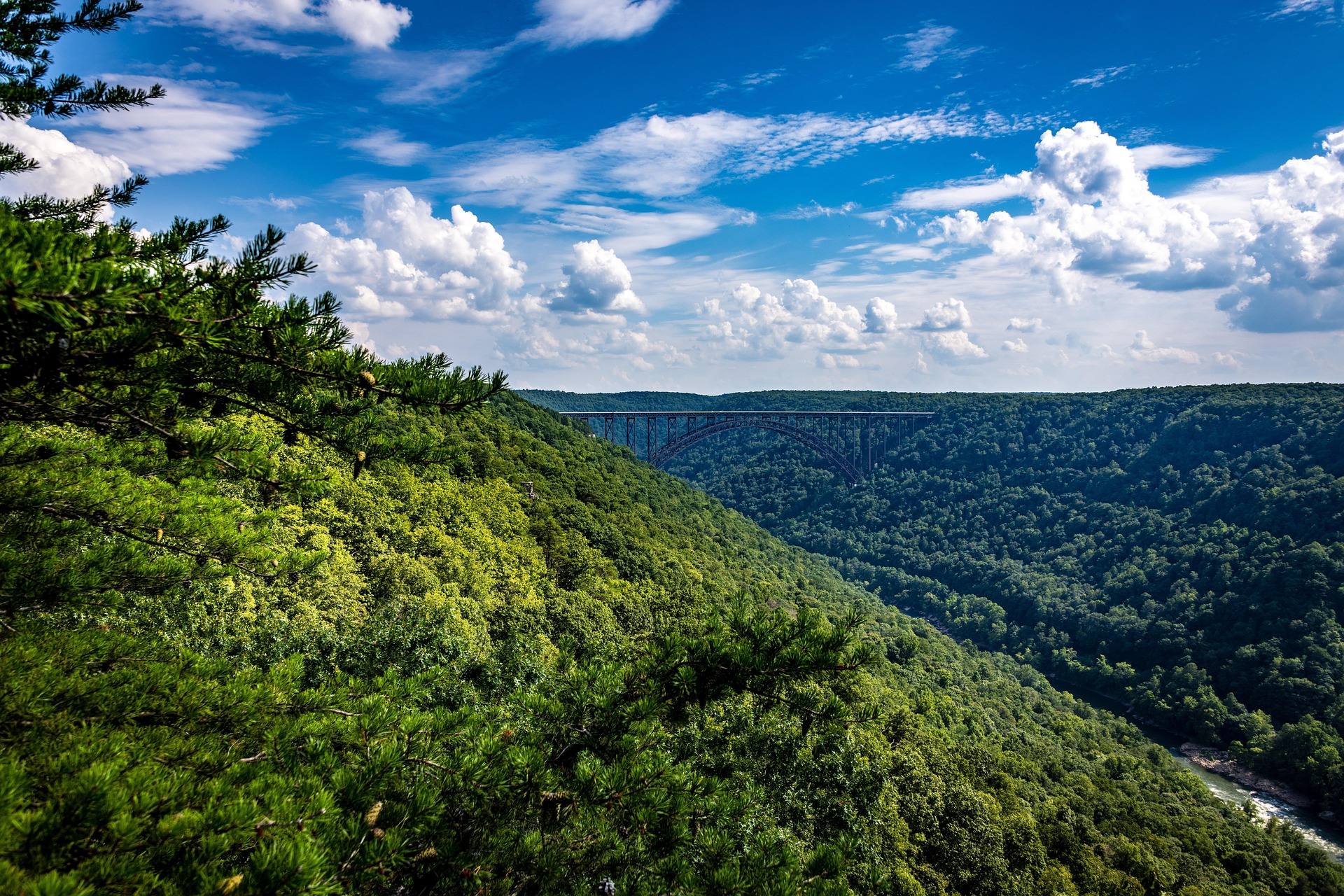
The park groups its trails by what they reach — rim views, historic mine sites, the river itself — rather than rating them by difficulty. Rim trails are level walking on old grades; anything dropping to the river gains that height back on the way out.
| Trail | Distance |
|---|---|
| Endless Wall Trail | 2.2–2.6 mi |
| Long Point Trail | 3.2 mi |
| Grandview Rim Trail | 3.2 mi |
Endless Wall Trail
Rim walking through hemlock and rhododendron to Diamond Point, with the gorge and the bridge in one view.
- Getting there
- Fern Creek or Nuttall trailheads off Lansing-Edmond Road
Long Point Trail
A rock promontory with the head-on view of the New River Gorge Bridge.
- Getting there
- Newton Road, Fayetteville
Grandview Rim Trail
Rim overlooks over the horseshoe bend of the New, well away from the bridge crowds.
- Getting there
- Grandview, off I-64 near Beckley
Blackwater Falls State Park
Twenty-one trails on the rim of the Blackwater Canyon, from quarter-mile boardwalks to rim routes that link into the Monongahela National Forest network and the Allegheny Trail.
| Trail | Distance | Difficulty | Elevation | Surface |
|---|---|---|---|---|
| Blackwater Falls Boardwalk Trail | 0.25 mi | Easy | More than 200 steps down | Stone patio and boardwalk |
| Gentle Trail | 0.25 mi | Easy | not published | Paved |
| Lindy Point Trail | 0.3 mi | Moderate to difficult | Overlook at 3,000 ft | not published |
| Elakala Trail | 0.5 mi | Moderate | not published | not published |
| River Road Trail | 1.56 mi | Easy | not published | Old railroad grade |
| Pace Point Trail | 0.7 mi | Moderate | not published | not published |
| Davis Trail | 0.25 mi | Moderate | not published | not published |
| Bald Knob Trail | 2.5 mi | Easy to moderate | Summit 4,308 ft | not published |
A dash means West Virginia State Parks does not publish that figure.
Blackwater Falls Boardwalk Trail
The observation deck beside the falls. The step count, not the distance, is what people underestimate.
- Surface
- Stone patio and boardwalk
- Getting there
- Main park area off WV 32 at Davis
Gentle Trail
A paved deck overlooking the falls, and the route to recommend to anyone who cannot manage stairs.
- Surface
- Paved
- Getting there
- North rim, off the park road
Lindy Point Trail
The most photographed sunset in the state, from a rock outcrop over the canyon.
- Getting there
- South rim road
Elakala Trail
A bridge directly over Elakala Falls, then rim walking above the canyon.
- Getting there
- Main park road opposite Balanced Rock Trail
River Road Trail
Level grade that links the park directly to the town of Davis, with fishing along it.
- Surface
- Old railroad grade
- Getting there
- Park road below the lodge
Davis Trail
Short link out of the park into the Monongahela National Forest network.
Bald Knob Trail
The widest view over Canaan Valley, from the top of the ski area.
- Getting there
- Canaan Valley Resort State Park, by chair lift or from the parking lot
Watoga State Park
West Virginia's largest state park, 10,100 acres above the Greenbrier River, with a trail network that includes 5.5 miles of the Allegheny Trail and a climb of over 1,000 feet onto Workman Ridge.
| Trail | Distance | Difficulty | Elevation | Surface |
|---|---|---|---|---|
| Jesse's Cove Trail | 2.5 mi | Moderate to difficult | Climb of more than 1,000 ft | not published |
| Ann Bailey Trail | 3 mi | Moderate to difficult | not published | Old roadbed; mountain bikes welcome |
| Arrowhead Trail | 1 mi | Difficult | not published | not published |
| Lake Trail | 1.5 mi | Easy | not published | not published |
A dash means West Virginia State Parks does not publish that figure.
Jesse's Cove Trail
Down the Greenbrier River to the mouth of Rock Run, then up Rock Run onto Workman Ridge.
- Getting there
- Watoga State Park
Ann Bailey Trail
Crosses Pyles Mountain and Workman Ridge to the Ann Bailey lookout tower.
- Surface
- Old roadbed; mountain bikes welcome
- Getting there
- Watoga State Park
Arrowhead Trail
The short steep way to the Ann Bailey tower and the Greenbrier River Valley view.
- Getting there
- Watoga State Park
Lake Trail
Circles Watoga Lake; the one flat walk in the park.
- Getting there
- Trailheads at the boat docks, the dam and the pool parking lot
Holly River State Park
Steep, wet, waterfall country in Webster County, with the longest state park trails in central West Virginia and an accessible paved loop with Braille interpretive signs.
| Trail | Distance | Difficulty | Elevation | Surface |
|---|---|---|---|---|
| Potato Knob Trail | 7.5 mi one-way | Moderate to difficult | Summit 2,480 ft | not published |
| Railroad Grade Trail | 10 mi | Moderate to difficult | not published | Old railroad grade |
| Tramontane Trail | 2.5 mi | Moderate | not published | not published |
| Reverie Trail | 3.5 mi | Moderate | not published | not published |
| Laurel Fork Trail | 0.4 mi | Easy | not published | Asphalt, ADA accessible |
A dash means West Virginia State Parks does not publish that figure.
Potato Knob Trail
Tenskwatawa Falls and the Potato Knob summit, reached by the section the park calls The Chute.
- Getting there
- Branches from the Wilderness Trail
Railroad Grade Trail
The longest trail in the park, on a logging grade past rock formations.
- Surface
- Old railroad grade
- Getting there
- Starts where the Wilderness Trail crosses Crooked Fork
Tramontane Trail
Mystic Falls at 2.3 miles, which the park calls its hidden waterfall.
- Getting there
- Holly River State Park
Reverie Trail
Passes under Tecumseh Falls on the way to the primitive camping area.
- Getting there
- Holly River State Park
Laurel Fork Trail
An accessible loop with rest stations and Braille interpretive signs.
- Surface
- Asphalt, ADA accessible
- Getting there
- Island between the Activity Building and the Carpenter Pavilion
Coopers Rock State Forest
The closest real trail network to Morgantown, reached from I-68. The main overlook is closed for bridge replacement, which makes Ravens Rock the view to walk to instead.
| Trail | Distance | Difficulty | Surface |
|---|---|---|---|
| Ravens Rock Trail | 1.5 mi | Moderate | Access road and trail |
| Rock City Trail | 1 mi | Easy | not published |
| Virgin Hemlock Trail | 1.2 mi | Easy | not published |
| Clay Run Trail | 1.8 mi | Moderate | not published |
| Ken's Run Trail | 4.5 mi | Moderate | not published |
| Mont Chateau Trail | 2.6 mi | Moderate to difficult | not published |
A dash means West Virginia State Parks does not publish that figure.
Ravens Rock Trail
A cliff edge above the Cheat River Canyon, and the view to walk to while the main overlook is closed for bridge replacement.
- Surface
- Access road and trail
- Getting there
- Coopers Rock State Forest, off I-68 east of Morgantown
Rock City Trail
A boulder labyrinth rather than a view — passages and crevices between house-sized blocks.
- Getting there
- From Picnic Shelter #3
Virgin Hemlock Trail
A hemlock grove over 300 years old, in a state that was almost entirely cut over.
- Getting there
- Starts at WV 73
Clay Run Trail
Ends at the Henry Clay iron furnace, built when this forest was charcoal supply.
- Getting there
- Across the road from the McCollum camping area entrance
Ken's Run Trail
The longest single trail in the forest.
- Getting there
- Sand Springs homestead to the archery range parking lot
Mont Chateau Trail
Drops to Cheat Lake near Mont Chateau.
- Getting there
- Begins at the Henry Clay iron furnace
Kanawha State Forest
More than 60 miles of trail across 9,300 acres, seven miles from downtown Charleston. Unusually for West Virginia, the forest publishes which trails are foot-only and which allow mountain bikes; the two sets share junctions.
| Trail | Distance | Difficulty | Surface |
|---|---|---|---|
| Spotted Salamander Trail | 0.25 mi | Easy | Wheelchair-accessible interpretive trail |
| Davis Creek Trail | 2.5 mi | Easy to moderate | Mountain bikes permitted |
| Rocky Ridge Trail | 2 mi | Moderate to difficult | Foot traffic only |
| Overlook Rock Trail | 1.5 mi | Moderate to difficult | Foot traffic only |
| Black Bear Mountain Bike Trail | 1 mi | Difficult | Mountain bike trail |
Spotted Salamander Trail
The accessible loop, seven miles from downtown Charleston.
- Surface
- Wheelchair-accessible interpretive trail
- Getting there
- Across the road from the old barn
Davis Creek Trail
Follows Davis Creek to Copperhead Rock below the stables.
- Surface
- Mountain bikes permitted
- Getting there
- Footbridge below the lake
Rocky Ridge Trail
Ridge climb that ends into Pigeon Roost Trail.
- Surface
- Foot traffic only
- Getting there
- Across from the Shelter #5 parking lot
Overlook Rock Trail
The nearest named overlook to Charleston, and most of the city has never walked it.
- Surface
- Foot traffic only
- Getting there
- Steep start south of the pool
Black Bear Mountain Bike Trail
Steep downhill to Pigeon Roost Trail, with a bypass around the feature the forest calls Spectator Falls.
- Surface
- Mountain bike trail
- Getting there
- From Middle Ridge Road
Babcock State Park
Above Glade Creek about 20 miles from the New River Gorge Bridge, with a long downhill grade to a vanished mining town and CCC stonework on the short connectors.
| Trail | Distance | Difficulty | Elevation | Surface |
|---|---|---|---|---|
| Old Sewell Trail | 9 mi | Moderate to challenging | Gradual, downhill | not published |
| Narrow Gauge Trail | 2.5 mi | Moderate | not published | Bed of the Manns Creek Railway, closed in 1956 |
| Skyline Trail | 2 mi | Moderate | not published | not published |
| Rocky Trail | 0.5 mi | Challenging | not published | CCC stone staircase from the 1930s |
A dash means West Virginia State Parks does not publish that figure.
Old Sewell Trail
Nine miles down to a former mining town, past a coal boiler and waterfalls, crossing into New River Gorge National Park.
- Getting there
- Babcock State Park at Clifftop, about 20 miles from the New River Gorge Bridge
Narrow Gauge Trail
An abandoned narrow-gauge railway bed; bikes are allowed but must be carried around the difficult sections.
- Surface
- Bed of the Manns Creek Railway, closed in 1956
- Getting there
- Babcock State Park
Skyline Trail
Follows a natural cliff line; return on the same route or the park roads.
- Getting there
- Babcock State Park
Rocky Trail
Half a mile of hand-built stone steps connecting the two main trails.
- Surface
- CCC stone staircase from the 1930s
- Getting there
- Between the Skyline and Narrow Gauge trails
Twin Falls Resort State Park
Two waterfalls on separate forks near Mullens, with the shortest paved approach to a waterfall in the southern coalfields and ridge loops behind it.
| Trail | Distance | Difficulty | Elevation | Surface |
|---|---|---|---|---|
| Falls Trail | 1.25 mi | Moderate | not published | Paved to Marsh Fork Falls, then unpaved |
| Cliffside Trail | 3.5 mi | Moderate to difficult | not published | Rocky on the outer loop |
| Poke Hollow Trail | 3.5 mi | Moderate | About 450 ft of elevation change | not published |
| Pathfinder Trail | 2.5 mi | Moderate | About 500 ft of gain | not published |
A dash means West Virginia State Parks does not publish that figure.
Falls Trail
Marsh Fork Falls on pavement, then Black Fork Falls, returning on an old park road.
- Surface
- Paved to Marsh Fork Falls, then unpaved
- Getting there
- Twin Falls Resort State Park at Mullens
Cliffside Trail
Two vistas on the outer loop, through rhododendron thicket.
- Surface
- Rocky on the outer loop
- Getting there
- Twin Falls Resort State Park
Poke Hollow Trail
The park's highest point, past two cemeteries, then down along a creek.
- Getting there
- Twin Falls Resort State Park
Pathfinder Trail
Ridge route through several forest types.
- Getting there
- Twin Falls Resort State Park
Pipestem Resort State Park
On the east rim of the Bluestone River Gorge, where every trail worth walking descends: the park publishes 500-foot drops to the river and an 8.5-mile through-route to Bluestone State Park.
| Trail | Distance | Difficulty | Elevation | Surface |
|---|---|---|---|---|
| Bluestone Turnpike Trail | 8.5 mi | Easy to moderate | not published | Natural surface |
| River Trail | 5.25 mi | Moderate to difficult | not published | Natural surface |
| Canyon Rim Trail | 0.7 mi | Easy to moderate | Descends 500 ft | Natural surface |
| Farley Loop | 3 mi | Moderate | not published | Natural surface |
A dash means West Virginia State Parks does not publish that figure.
Bluestone Turnpike Trail
Runs the Bluestone River all the way to Bluestone State Park, following an old turnpike route through the gorge.
- Surface
- Natural surface
- Getting there
- Begins at the Farley Loop and River Trail junction in Pipestem Resort State Park
River Trail
Switchbacks and river wading down to the Farley Loop junction in the Bluestone gorge.
- Surface
- Natural surface
- Getting there
- Begins behind McKeever Lodge
Canyon Rim Trail
Heritage Point, a massive sandstone outcrop with the Bluestone River Gorge below.
- Surface
- Natural surface
- Getting there
- Pipestem Resort State Park
Farley Loop
The park calls it its most rugged trail: Raven Rock overlook, then down to the Bluestone River.
- Surface
- Natural surface
- Getting there
- Begins behind Mountain Creek Lodge
Cacapon Resort State Park
Over 6,000 acres at Berkeley Springs on Cacapon Mountain, which the park describes as the highest mountain in the eastern panhandle at 2,200 feet.
| Trail | Distance | Difficulty | Elevation |
|---|---|---|---|
| Ziler Trail | 5 mi | Moderate | Summit 2,200 ft |
| Central Trail | 5 mi | Moderate | not published |
| Laurel Trail | 2 mi | Moderate | not published |
| Piney Ridge Trail | 1 mi | Easy | 950 to 1,100 ft |
A dash means West Virginia State Parks does not publish that figure.
Ziler Trail
The top of Cacapon Mountain, which the park calls the highest mountain in the eastern panhandle.
- Getting there
- Cacapon Resort State Park at Berkeley Springs
Central Trail
Bear Den Rocks and valley overlooks, crossing the north and middle forks of Indian Run.
- Getting there
- Cacapon Resort State Park
Laurel Trail
A crag over the Sleepy Creek valley, with Keefer sandstone outcrops.
- Getting there
- Cacapon Resort State Park
Piney Ridge Trail
Pine and mixed oak, and the easiest walking in the park.
- Getting there
- Cacapon Resort State Park