Can we count this visit? We use Google Analytics to see which guides people read, so we
know what to write next. It sets cookies and shares usage data with Google. Say no and the site
works exactly the same — nothing is loaded and nothing is sent.
What we collect.
Every organization we link to: local tourism offices, the state and federal agencies that manage the land, the nonprofits and clubs that keep access open, and the universities doing the research.
West Virginia has roughly 1.5 million acres of public land and a handful of places that carry almost all of the attention. The consequence is that a great deal of very good ground sits nearly empty, usually for one of three reasons: nobody has heard of it, the road in is gated or rough, or it is undeveloped and has nothing to advertise. Those are the places below — of them across regions.
Put-ins, take-outs and public landings on the ten major rivers, with the reach each one serves.
Most West Virginia rivers have no published list of their own access points.
The National Park Service names its river access inside the New River Gorge, and Friends of the Cheat publishes what each of its sites has and what it still needs. Everywhere else, the public record is mostly the reach: where a run starts, where it ends and how hard it is. That is what this page carries, and it marks the difference rather than filling the gap with a guess.
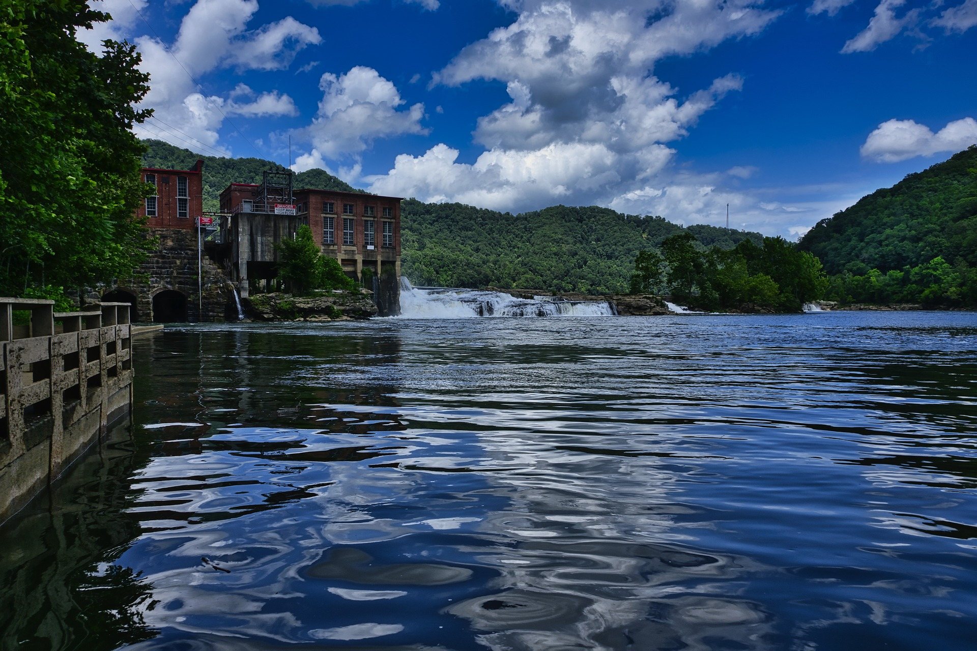
A low dam and hydroelectric plant on a broad West Virginia river
New River · 16 sites
New River
Access inside the gorge is almost entirely federal, and the National Park Service names its public river access points rather than rating them. There is no entrance fee to the park and no camping fee at park campgrounds, but the campgrounds are primitive: no drinking water, no hookups, no electricity and limited restrooms. The river changes character at Thurmond — Hinton down to Thurmond is Class I–III, and below Thurmond it narrows into technical Class III–IV.
Fayette Station Road is one-way for eight miles and vehicles over 12 feet cannot complete it, so it constrains which shuttle vehicle you can use. The water around Sandstone Falls has been the site of several drownings.
Reaches
Bluestone Dam→SandstoneI–II
Sandstone→McCreeryI–III
McCreery→ThurmondI–III
Thurmond→CunardIII
Cunard→Fayette StationIII–IV
Hawks Nest Dam→Gauley Bridgethe New River Dries
Access points
Tug Creek BeachRiver access · River Road, HintonFacilities not published · No park entrance feeBluestone Dam to Sandstone
Brooks FallsRiver access · River Road, HintonTrail, picnic area, small boardwalk view · No park entrance feeBluestone Dam to Sandstone
Hellems BeachRiver access · River Road, HintonFacilities not published · No park entrance feeBluestone Dam to Sandstone
Sandstone Falls day-use areaDay use and river access · River Road, eight miles downstream of Hinton via WV 20 from I-64 exit 139Parking, boardwalk and bridges across two islands below the falls · No park entrance feeBluestone Dam to Sandstone
Meadow CreekRiver access with campground · Off WV 41 near Prince, parking along Claypol RoadPrimitive campground: no drinking water, no hookups, limited restrooms · No camping feeSandstone to McCreery
McCreeryRiver access · Off WV 41 near PrinceFacilities not published · No park entrance feeSandstone to McCreery
Grandview SandbarRiver access with campground · Off WV 41 near PrincePrimitive campground · No camping feeMcCreery to Thurmond
Mill CreekRiver access · Off WV 41 near PrinceParking along State Route 5 is sparse · No park entrance feeMcCreery to Thurmond
Glade CreekRiver access with campground · Off WV 41 near PrincePrimitive campground · No camping feeMcCreery to Thurmond
Army CampRiver access with campground · Inside the national parkPrimitive campground; the park describes easy access to the river for fishing and boating · No camping feenot published
BrooklynRiver access with campground · Inside the national parkPrimitive campground · No camping feeThurmond to Cunard
ThayerRiver access with campground · Inside the national parkPrimitive campground · No camping feeThurmond to Cunard
Stone CliffRiver access with campground · Near ThurmondPrimitive campground · No camping feeThurmond to Cunard
DunglenRiver access · Near ThurmondFacilities not published · No park entrance feeThurmond to Cunard
CunardRiver access · Cunard Road from FayettevilleFacilities not published · No park entrance feeCunard to Fayette Station — the commercial put-in
Fayette StationRiver access · Bottom of Fayette Station Road, off Lansing-Edmond Road near FayettevilleParking at the bottom of the road; the road is one-way for eight miles and vehicles over 12 feet cannot complete it · No park entrance feeCunard to Fayette Station — take-out
The whitewater Gauley is two reaches below the Army Corps dam: Summersville Dam to Woods Ferry, the Upper at Class IV–V, and Woods Ferry to Swiss, the Lower at Class III–IV. Because the put-in is the dam tailwater, the season is set by scheduled reservoir releases rather than rainfall. Camping at the top end is at Gauley Tailwaters in the national recreation area, with no camping fee.
Summersville Dam, Woods Ferry and Swiss are three separate road approaches, not a loop: a shuttle is not optional here. The upper river above Camden-on-Gauley is Class I–III and has nothing to do with the release-fed canyon.
Reaches
Summersville Dam→Woods FerryIV–V, the Upper Gauley
Woods Ferry→SwissIII–IV(V), the Lower Gauley
Turkey Fork confluence→BolairI–III
Bolair→DonaldsonI–III
Donaldson→Camden-on-GauleyI–III
Camden-on-Gauley→Curtin BridgeI–III
Access points
Summersville Dam tailwaterPut-in for the Upper Gauley · Below Summersville DamFacilities not publishedSummersville Dam to Woods Ferry
Woods FerryTake-out and put-in · Woods Ferry Road, Nicholas CountyFacilities not publishedUpper Gauley take-out, Lower Gauley put-in
SwissTake-out · Swiss, Nicholas CountyFacilities not publishedLower Gauley take-out
Gauley Tailwaters campgroundCampground at the put-in end · Gauley River National Recreation AreaPrimitive; site count not published · No camping feeSummersville Dam tailwater
Managed by National Park Service and the US Army Corps of Engineers. Source
Greenbrier River · 7 sites
Greenbrier River
Access here is organised around the Greenbrier River Trail rather than around boat ramps, because the rail-trail runs the bank for 78 miles. The trail's own planning page names canoe access at North Caldwell, mile 3, reached across US 60 from the Caldwell boat launch, and at Renick, mile 24.5. The whole river is Class I–II with one Class III noted between Spring Creek and Anthony, so water level rather than difficulty decides the day.
Do not assume every trail milepost is a launch. Shuttles are easier here than on any other West Virginia river: bike-and-shuttle operators work out of Marlinton and Caldwell, and the Mountain Transit Authority asks for a day's notice.
Reaches
Durbin→HostermanI–II
Hosterman→CassI–II
Cass→Clover LickI–II
Clover Lick→Laurel RunI–II
Laurel Run→MarlintonI–II
Spring Creek→AnthonyI(III)
Ronceverte→Fort SpringI–II
Fort Spring→AldersonI–II
Talcott→Willowood BridgeI–II
Willowood Bridge→BellepointI–II
Access points
Caldwell boat launchCanoe access · Caldwell, across US 60 from the North Caldwell trailhead at trail mile 3Trail parking at the North Caldwell trailheadRonceverte to Fort Spring
Renick canoe accessCanoe access · Renick, trail mile 24.5Trail access with parkingLaurel Run to Marlinton
MarlintonReach endpoint · Marlinton, US 219, trail mile 56Facilities not publishedLaurel Run to Marlinton take-out
CassReach endpoint · Cass Scenic Railroad State Park, off State Route 66Facilities not publishedHosterman to Cass
AnthonyReach endpoint · Anthony, Greenbrier CountyFacilities not publishedSpring Creek to Anthony take-out
AldersonReach endpoint · Alderson, Greenbrier CountyFacilities not publishedFort Spring to Alderson take-out
BellepointReach endpoint · Bellepoint at HintonFacilities not publishedWillowood Bridge to Bellepoint take-out
Managed by West Virginia State Parks, with the Greenbrier River Trail Association. Source
Cheat River · 8 sites
Cheat River
The Cheat is the one West Virginia river where a nonprofit is the visible access manager, and the sites are actively being rebuilt. Friends of the Cheat publishes what each one is and what it still needs. On the Narrows, The Driveway off Route 72 is the put-in and the Cheat River Trailhead at Kingwood is the take-out; the Canyon run ends at Jenkinsburg, owned by the West Virginia Land Trust since 2020 and co-managed with Friends of the Cheat.
The Caves, also called YaYa's Landing, was acquired in 2025 but its stairs and raft slide are not built — do not plan a trip around it. On Big Sandy Creek the Rockville bridge has been closed since August 2020: the river-left approach needs a high-clearance vehicle and crosses private land, and the Pisgah side is the better road.
Rowlesburg→Cheat River TrailheadII–III, the Narrows
Albright→Jenkinsburg BridgeIII–IV, the Canyon
Jenkinsburg Bridge→Cheat LakeIII
Access points
The DrivewayCarry-down put-in on an easy sloped path · Along Route 72, Cheat NarrowsThe largest parking area on Route 72; further parking work plannedThe Narrows
Cheat River TrailheadTake-out with a path up to the parking lot · 10922 River Road, KingwoodAccessible parking, wayfinding signage, rest areas, water bottle filling stations, the Keith Pitzer Memorial Pavilion; open dawn to duskThe Narrows take-out
JenkinsburgTake-out and put-in · Jenkinsburg Bridge, Preston CountyRoad maintained; the bridge remains openCanyon take-out, Cheat Lake put-in
The Caves / YaYa's LandingNot yet built — concrete stairs and a raft slide are planned · Cheat NarrowsExpanded parking planned; Friends of the Cheat put the remaining cost at about $570,000The Narrows
Rockville access, Big Sandy CreekCreek access · Rockville, Valley Point side and Pisgah sideBridge closed since August 2020; the river-left road needs high clearance and crosses private property, the Pisgah road is in better conditionBig Sandy Creek to the Cheat
Friends of the Cheat campgroundRiverside campground at the Canyon put-in end · 139 Beech Run Road, AlbrightVault toilets, potable water, primitive designated sites only, no hookups and no generators · $20 per site per day for up to four people, $10 for members, paid at the back-gate stationCanyon put-in area
AlbrightPut-in · Albright, Preston CountyFacilities not publishedThe Canyon
RowlesburgPut-in · Rowlesburg, Preston CountyFacilities not publishedThe Narrows
Managed by Friends of the Cheat and the West Virginia Land Trust. Source
Tygart Valley River · 5 sites
Tygart Valley River
The Tygart is not one river. Class I–II farm-country floats sit immediately upstream of Class III–V gorge runs, and the reach you choose matters more here than on any other river in the state. No agency publishes its access sites, so what follows are the reach endpoints American Whitewater names.
Both the Tygart Gorge below Belington and the Arden section are rated Class III–V. Neither is a step up from the easy water above them; they are different rivers.
Reaches
Valley Head→US 219 bridge near Elkwater ForkII+
US 219 bridge→HuttonI–II
Aggregates→Beaver Creek confluenceII–III+, the Loop
Belington→Buckhannon River confluenceIII–V, the Gorge
Above Arden→Big Cove RunIII–V, the Arden section
Valley Falls→HammondII–IV
Access points
Valley HeadReach endpoint · Valley Head, Randolph CountyFacilities not publishedValley Head to the US 219 bridge
HuttonReach endpoint · Hutton, Randolph CountyFacilities not publishedUS 219 bridge to Hutton
BelingtonReach endpoint · Belington, Barbour CountyFacilities not publishedThe Gorge put-in
Valley FallsReach endpoint · Valley Falls State Park, Marion CountyFacilities not publishedValley Falls to Hammond put-in
HammondReach endpoint · Hammond, Marion CountyFacilities not publishedValley Falls to Hammond take-out
The single most important thing about the upper Elk is in the name American Whitewater gives its top reach: the Dry Bed of the Elk. The river loses its flow underground above Elk Springs, so the Slatyfork section is not reliably runnable. Below Webster Springs it settles into Class II–III. The Elk River Trail now follows 73 miles of the corridor from Clendenin to Gassaway, which is the easiest bank access on the river.
WVDNR lists the upper Elk among its stocked trout waters, so bank access exists, but the agency publishes individual sites only through its interactive map rather than as a list.
Reaches
Slatyfork→Elk Springs fish hatcheryII–III, the Dry Bed of the Elk
Elk Springs→BergooII–III
Bergoo→Webster SpringsII–III
Webster Springs→CR 7 bridgeII–III, Down Elk
Access points
SlatyforkReach endpoint · Slatyfork, US 219Facilities not publishedDry Bed of the Elk put-in
Elk SpringsReach endpoint · Elk Springs fish hatcheryFacilities not publishedSlatyfork to Elk Springs take-out
Webster SpringsReach endpoint · Webster Springs, Webster CountyFacilities not publishedDown Elk put-in
CR 7 bridge and gauging stationReach endpoint · County Route 7Facilities not publishedDown Elk take-out
Managed by not published for individual sites. Source
South Branch of the Potomac · 5 sites
South Branch of the Potomac
Two signature sections sit on this river, and both are bracketed by named landings: Smoke Hole Canyon, which splits at Big Bend Campground into an upper run at Class I–III+ and a lower at Class I–II(III), and the Trough, which runs from the US 220 bridge north of Moorefield down to Harmison's Landing. Nothing here is harder than Class III+, so shuttle distance and low summer water are the real planning problems.
Harmison's Landing is a named landing whose ownership and access terms are not published. Check locally before relying on it.
Reaches
Virginia line→CR 23 bridgeI–II
CR 23 bridge→RuddleI–II
US 220 bridge north of Upper Tract→Big Bend CampgroundI–III+, upper Smoke Hole
Big Bend Campground→PetersburgI–II(III), lower Smoke Hole
US 220 north of Moorefield→Harmison's LandingI–II, the Trough
Access points
US 220 bridge north of Upper TractPut-in · US 220, Pendleton CountyFacilities not publishedUpper Smoke Hole
Big Bend CampgroundCampground and river access · Smoke Hole, Monongahela National ForestCampground; facility detail not published in the sources checkedUpper Smoke Hole take-out, lower Smoke Hole put-in
South Grove Street, PetersburgTake-out · Petersburg, Grant CountyFacilities not publishedLower Smoke Hole take-out
US 220 bridge north of MoorefieldPut-in · US 220, Hardy CountyFacilities not publishedThe Trough put-in
Harmison's LandingLanding · Hardy CountyFacilities not publishedThe Trough take-out
Managed by not published for individual sites. Source
Cacapon River · 5 sites
Cacapon River
The whole river is Class I–II, and the classic run is the Caudy's Castle reach from US 50 down to the WV 127 bridge at Bloomery. Two of the six named access points are businesses or crossings rather than public facilities, which is the thing to check before you commit to a shuttle.
No published confirmation exists that Stoney Creek Store or Cacapon Crossing are public access sites with parking. Ask first.
Reaches
Capon Lake→Capon BridgeI
Capon Bridge, US 50→WV 127 bridge at BloomeryII, Caudy's Castle
WV 127 bridge→Cacapon CrossingI–II
Cacapon Crossing→LargentI–II
Largent→Fishers FordI–II
Access points
Capon Lake Whipple Truss BridgePut-in at a historic truss bridge · Capon Lake, Hampshire CountyFacilities not publishedCapon Lake to Capon Bridge
Capon BridgeTake-out and put-in · US 50, Hampshire CountyFacilities not publishedCaudy's Castle put-in
WV 127 bridge, BloomeryTake-out and put-in · WV 127, Hampshire CountyFacilities not publishedCaudy's Castle take-out
Stoney Creek Store, LargentReach endpoint at a business · Largent, Morgan CountyFacilities not publishedLower Cacapon put-in
Fishers FordReach endpoint · Morgan CountyFacilities not publishedLower Cacapon take-out
Managed by not published for individual sites. Source
Bluestone River · 3 sites
Bluestone River
Two published reaches, Spanishburg to Eads Mill at Class I–III and Eads Mill to Bluestone State Park at Class II–III. The lower take-out is on impounded water at the park rather than on free-flowing river, which is the part people misjudge. Bluestone National Scenic River protects the gorge downstream, and the Bluestone Turnpike Trail walks it.
Bluestone State Park's launch surface, parking and fees are not published on the pages checked.
Reaches
Spanishburg→Eads MillI–III
Eads Mill→Bluestone State ParkII–III
Access points
SpanishburgPut-in · Spanishburg, Mercer CountyFacilities not publishedSpanishburg to Eads Mill
Eads MillTake-out and put-in · Mercer CountyFacilities not publishedBoth reaches
Bluestone State ParkTake-out with public launches · Near Hinton, Summers CountyPublic boat launches on the Bluestone River and at Bluestone Lake; marina rentalsEads Mill to Bluestone State Park
Managed by West Virginia State Parks at the lower end. Source
Meadow River · 4 sites
Meadow River
A Gauley tributary where difficulty escalates sharply downstream: the Upper Meadow is III–IV+(V), the Middle is III–IV, and the Lower is a flat Class V. That makes the Route 19 bridge the most consequential decision point on the river, because putting in there commits you to Class V.
The Lower Meadow takes out at the Gauley confluence, so a Meadow trip finishes as a Gauley trip and needs a Gauley-scale shuttle.
Reaches
East Rainelle→RussellvilleIII–IV+(V), the Upper
Nallen→Route 19 bridgeIII–IV, the Middle
Route 19 bridge→Gauley confluenceV, the Lower
Access points
East RainellePut-in · East Rainelle, Greenbrier CountyFacilities not publishedUpper Meadow
RussellvilleTake-out · Fayette CountyFacilities not publishedUpper Meadow
NallenPut-in · Nallen, Fayette CountyFacilities not publishedMiddle Meadow
Route 19 bridgeTake-out and put-in · US 19, Fayette CountyFacilities not publishedMiddle Meadow take-out, Lower Meadow put-in
Managed by not published for individual sites. Source