
First visit
Endless Wall Trail
Endless Wall Trail, the Canyon Rim overlook, and a rafting day on the Lower New. Base in Fayetteville and eat well.
Full guide to Endless Wall Trail →The New River has cut a gorge roughly 1,000 feet deep through Nuttall sandstone, protected since 2020 as New River Gorge National Park and Preserve. The cliff bands hold more than 1,600 established climbing routes, the largest concentration of sandstone climbing in the eastern United States. The Gauley River, immediately north, runs on scheduled autumn dam releases from Summersville Lake. Upstream the New widens through Sandstone Falls and the Bluestone gorge, where visitation drops sharply.
Most visitors see the bridge, run a raft trip and leave. The gorge also contains a series of abandoned coal towns at river level, reachable by trail and by narrow access roads, that receive a small fraction of the traffic.
This is the most-visited outdoor region in West Virginia. Below are the standard first-trip stops, the second-trip stops, and what people who live here do instead.
Endless Wall Trail, the Canyon Rim overlook, and a rafting day on the Lower New. Base in Fayetteville and eat well.
Full guide to Endless Wall Trail →Nuttallburg and Kaymoor. Abandoned coal towns at the bottom of the gorge, with the country's most complete surviving coal conveyor standing in the woods.
Full guide to Nuttallburg →Grandview in late May for the rhododendron, Sandstone Falls on a summer evening, and Summersville Lake before the crowds show up in July.
Full guide to Grandview →Sunrise at Grandview, Endless Wall mid-morning before the trail fills, lunch in Fayetteville, an afternoon swimming at Summersville, and Long Point at sunset for the bridge.
October weekends here are oversubscribed. Bridge Day brings tens of thousands of people and every road within twenty miles backs up. If you want the gorge in fall, come mid-week.
The primary service town for the New River Gorge, built around a walkable courthouse square with climbing shops, rafting outfitters, restaurants and breweries.
Located between Summersville Lake and the Gauley River put-ins, with chain lodging, groceries and services along US 19.
A railroad town on the New River below Bluestone Dam, with a preserved brick downtown and a stop on Amtrak's Cardinal route.
Six weekends a year, Summersville Dam opens and the Gauley carries the most concentrated whitewater in the eastern United States.
4 days · Sep–NovSharp Nuttall sandstone, stiff grades and the best autumn friction in the East.
Summersville Lake, the clearest water in the state, with lakeside sport climbing.
Sandstone Falls, 1,500 feet wide, with a fully accessible boardwalk.
Where, in this region
Local organizations
Summersville Lake, the clearest water in the state, with lakeside sport climbing.
Where, in this region
Local organizations
1 place in the New River Gorge carry bouldering.
Where, in this region
Local organizations
Upper Gauley, on release weekends each September and October.
Where, in this region
Local organizations
4 places in the New River Gorge carry whitewater kayaking.
Where, in this region
Local organizations
Whitewater Kayaking across West Virginia →Arrowhead Trails and the Summit Bechtel Reserve for purpose-built mountain biking.
Sandstone Falls, 1,500 feet wide, with a fully accessible boardwalk.
Where, in this region
Local organizations
Arrowhead Trails and the Summit Bechtel Reserve for purpose-built mountain biking.
Where, in this region
Local organizations
Mountain Biking across West Virginia →16 places in the New River Gorge carry fishing.
Where, in this region
Local organizations
7 places in the New River Gorge carry camping.
Where, in this region
Local organizations
Camping across West Virginia →Sandstone Falls, 1,500 feet wide, with a fully accessible boardwalk.
Where, in this region
Arrowhead Trails and the Summit Bechtel Reserve for purpose-built mountain biking.
Where, in this region
Local organizations
Sandstone Falls, 1,500 feet wide, with a fully accessible boardwalk.
Where, in this region
Local organizations
Outdoor Photography across West Virginia →1 place in the New River Gorge carry golf.
Where, in this region
25 named destinations in this region.
A 3,030-foot steel arch carrying US 19 some 876 feet above the New River — for decades the longest single-span arch bridge in the world, and still the image most people carry of West Virginia.
A 2.4-mile point-to-point trail along the gorge rim through hemlock and rhododendron, crossing Fern Creek on a footbridge and reaching Diamond Point, an exposed rock outcrop with a view up the gorge to the bridge.
About 3.2 miles round trip on mostly level old roadbed to a rock promontory below the rim, which provides the most-photographed view of the New River Gorge Bridge.
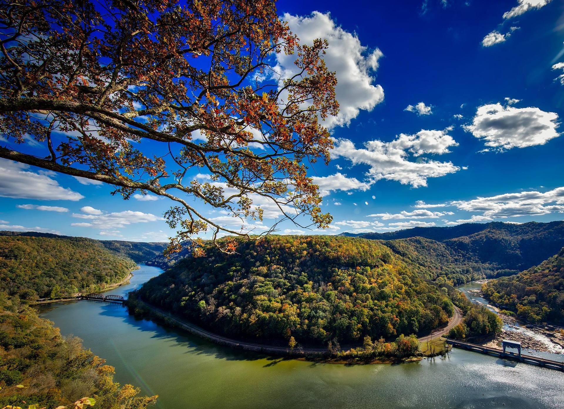
1,400 feet above a horseshoe bend in the New, with a seven-mile view up the gorge — the widest perspective anywhere in the park.
The largest waterfall on the New River — not tall, but 1,500 feet wide, spilling across the full breadth of the river between islands at the point where the gorge begins to open.
A steep descent from the gorge rim to the ruins of the Kaymoor One coal mine and processing plant, including 821 wooden steps down the former haulage incline.
An abandoned coal town at the bottom of the gorge with the most complete surviving coal conveyor and tipple complex in the country — a 1,385-foot inclined conveyor running straight up the hillside, once operated by Henry Ford.
The most celebrated whitewater in the eastern United States.
The commercial rafting heart of West Virginia: Class III–IV big-volume water through the deepest part of the gorge, with named rapids including Surprise, Upper and Lower Railroad, Double Z, Greyhound and Fayette Station under the bridge.
West Virginia's largest lake and by a wide margin its clearest — 2,700 acres of blue-green water in a sandstone basin, popular for scuba diving, paddleboarding and boating.
A long band of high-quality Nuttall sandstone on the gorge rim above Fayetteville, with a concentration of classic moderate trad and sport routes and one of the best views from any belay in the East.
The Meadow is two things at once: an exceptional and demanding whitewater run, and one of the most significant new climbing developments in the eastern United States over the past decade, with hundreds of routes established on clean sandstone in a deep, quiet gorge.
Purpose-built flow and cross-country mountain bike singletrack inside the national park near Fayetteville, built by the Boy Scouts and open to the public — a deliberate contrast to West Virginia's traditionally rugged riding, with bermed corners, rollers and progressive difficulty.
Home of the Glade Creek Grist Mill, the most photographed building in West Virginia — a working reconstruction assembled from parts of three historic mills, sitting on a boulder-strewn creek.
A full resort park perched above the Bluestone Canyon, with an aerial tram descending 1,100 feet to a lodge on the river — the only state park tram in West Virginia.
A rim-top lodge above the Mill Creek arm of the New River Gorge with an aerial tram to a marina on the water.
Designated a national park and preserve in 2020, protecting roughly 53 miles of the New River where it has cut about 1,000 feet through Nuttall sandstone.
Ten miles of protected river in a deep, wooded gorge between Bluestone Lake and Pipestem — the least-visited National Park Service unit in West Virginia and the quietest.
A Civil War battlefield on a bluff above the Gauley River with overlooks into the canyon and trails dropping toward the water.
On the shore of Bluestone Lake, the third-largest body of water in West Virginia, at the point where the Bluestone River meets the New.
An unusual pairing of a small developed park inside a much larger state forest in Mercer County, with two waterfalls on Camp Creek, mountain bike and equestrian trails, and camping.
A small day-use park in Mercer County built around a jagged sandstone fin standing above the highway, with a stairway to the top and a view over the southern coalfields.
A park just off I-64 near Beckley with an 18-acre lake, a seasonal campground, an extensive trail network used for running and mountain biking, and easy access from the interstate.
An 18-hole course plus a par-3 layout at Pipestem Resort State Park above the Bluestone Canyon, with lodge accommodation on site and a par-3 course that suits beginners and short visits.
Eight and a half miles along the Bluestone River between Pipestem Resort State Park and Bluestone State Park, following the line of an old turnpike through the gorge.
Regional placement for operators based in or serving the New River Gorge. Capped at three per page.
List your business hereAgencies, watershed groups and access organizations tied specifically to this region.
Every organization we link to: local tourism offices, the state and federal agencies that manage the land, the nonprofits and clubs that keep access open, and the universities doing the research.
West Virginia has roughly 1.5 million acres of public land and a handful of places that carry almost all of the attention. The consequence is that a great deal of very good ground sits nearly empty, usually for one of three reasons: nobody has heard of it, the road in is gated or rough, or it is undeveloped and has nothing to advertise. Those are the places below — of them across regions.