
Every organization we link to: local tourism offices, the state and federal agencies that manage the land, the nonprofits and clubs that keep access open, and the universities doing the research.
Summersville Lake
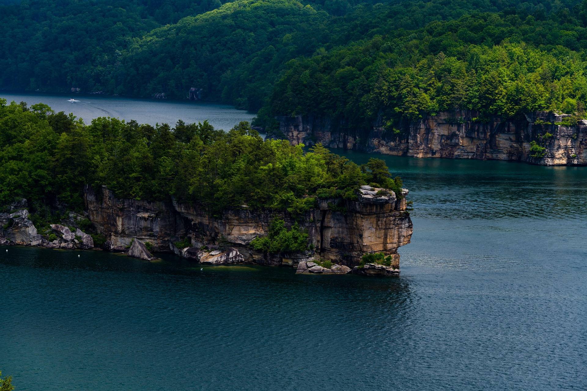
West Virginia's largest lake and by a wide margin its clearest — 2,700 acres of blue-green water in a sandstone basin, popular for scuba diving, paddleboarding and boating. The shoreline cliffs at Long Point, Pirates Cove and Whippoorwill hold lakeside sport climbing and deep-water soloing. The lake is drawn down each autumn for flood storage and to feed the Gauley releases, exposing beaches and changing the whole character of the place.
Know before you go
- Water clarity is best in early summer before algae
- Battle Run Campground is the Corps site on the lake
- Climbing access to some walls is by boat only
- 2,700 acres, the largest lake in West Virginia, with unlimited horsepower but no-wake and restricted zones
- Summersville Lake State Park opened on 177 acres of the north shore with three campgrounds: Overlook, Deer Run and Joe Branch
- The reservoir is drawn down each autumn for flood storage, which changes the shoreline and the cliff base
What you can do here
The clearest lake in West Virginia, set in a sandstone basin, is the state's standout paddleboard water, and clarity is best in early summer before algae. Horsepower is unlimited outside the no-wake and restricted zones, so know where those are before you get on the water. The autumn drawdown lowers the lake, and the launch you used in June may be dry in October.
Local organizations
A Corps reservoir holds usable water when the rivers are too low or too high, and this one gives you cliff lines at Long Point, Pirates Cove and Whippoorwill to paddle under. Motor traffic is unrestricted in horsepower outside the no-wake and restricted zones, so pick your hours and your line accordingly. The autumn drawdown moves launches and shoreline.
Local organizations
Shoreline cliffs at Long Point, Pirates Cove and Whippoorwill hold lakeside sport routes and deep-water soloing, and access to some walls is by boat only. The autumn drawdown changes the cliff base, which matters for landings and for what sits above water. The season runs roughly March through November, and none of this is beginner rock.
Local organizations
Bouldering is listed but no problems, grades or areas are published here. What the record does describe is sandstone shoreline at Long Point, Pirates Cove and Whippoorwill, and a reservoir drawn down each autumn that exposes beaches and the base of the rock — which is a plausible reason the listed season runs September through May. Ask locally what is developed before driving out with pads.
Local organizations
This is the largest lake in the state, with unlimited horsepower and both no-wake and restricted zones you need to know before launching. Maximum depth is 327 feet and the water is the clearest in West Virginia. Each autumn the reservoir is drawn down, which moves the shoreline and can change which ramps are usable, so check the level before towing.
Local organizations
Deep, clear reservoir water fishes differently from stained lakes — 327 feet at the maximum, and clarity best in early summer before algae, which usually pushes fishing to early, late or deep. Nothing is published here about what is stocked, so check current WVDNR regulations for the lake. The autumn drawdown shrinks the pool and rearranges the structure.
Local organizations
Battle Run is the Corps campground on the lake. Summersville Lake State Park opened on 177 acres of the north shore with three campgrounds of its own: Overlook, Deer Run and Joe Branch. Corps sites and state park sites book through different systems, so decide which one you are aiming at before you start hunting for a site.
Local organizations
Camping across West Virginia →Clarity is the argument for swimming here over most of the state's lakes, and it is best in early summer before algae sets in. The lake is deep, 327 feet at maximum, and carries unlimited-horsepower traffic outside the no-wake and restricted zones, so get in where boats are excluded. The autumn drawdown exposes beaches that do not exist in June.
Summersville is one of the reservoirs carrying the state's dinghy and small-keelboat sailing. Two things shape a day: mountain wind is fluky and thermally driven, so afternoons are usually best, and a basin ringed by sandstone cliffs will block and bend whatever breeze there is. Check the level before hauling a boat, since the lake is drawn down each autumn.
Guides, gear and lodging near Summersville Lake
Place-level placement for operators within range of this trailhead, put-in or crag.
List your business hereNearby in the New River Gorge
New River Gorge Bridge
A 3,030-foot steel arch carrying US 19 some 876 feet above the New River — for decades the longest single-span arch bridge in the world, and still the image most people carry of West Virginia.
Endless Wall Trail
A 2.4-mile point-to-point trail along the gorge rim through hemlock and rhododendron, crossing Fern Creek on a footbridge and reaching Diamond Point, an exposed rock outcrop with a view up the gorge to the bridge.
Long Point Trail
About 3.2 miles round trip on mostly level old roadbed to a rock promontory below the rim, which provides the most-photographed view of the New River Gorge Bridge.
Grandview
1,400 feet above a horseshoe bend in the New, with a seven-mile view up the gorge — the widest perspective anywhere in the park.
Sandstone Falls
The largest waterfall on the New River — not tall, but 1,500 feet wide, spilling across the full breadth of the river between islands at the point where the gorge begins to open.
Kaymoor Miners Trail
A steep descent from the gorge rim to the ruins of the Kaymoor One coal mine and processing plant, including 821 wooden steps down the former haulage incline.
West Virginia has roughly 1.5 million acres of public land and a handful of places that carry almost all of the attention. The consequence is that a great deal of very good ground sits nearly empty, usually for one of three reasons: nobody has heard of it, the road in is gated or rough, or it is undeveloped and has nothing to advertise. Those are the places below — of them across regions.