
Every organization we link to: local tourism offices, the state and federal agencies that manage the land, the nonprofits and clubs that keep access open, and the universities doing the research.
New River Gorge National Park and Preserve
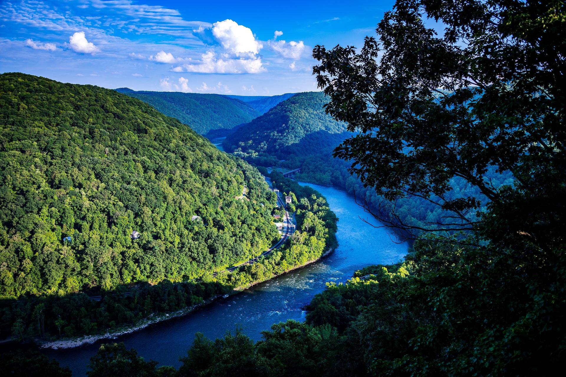
Designated a national park and preserve in 2020, protecting roughly 53 miles of the New River where it has cut about 1,000 feet through Nuttall sandstone. There is no single entrance and no loop road — the park is assembled from separate access points that can be forty minutes apart, from Canyon Rim beside the bridge to Grandview in the south and the coal towns down on the river.
Know before you go
- Mapping apps misroute in the gorge, so carry the official park map
- Canyon Rim for the bridge, Grandview for the rim, Thurmond and Nuttallburg for the coal history
- No entrance fee, though campgrounds and commercial rafting are priced separately
What you can do here
There is no loop road and no single entrance, so hiking here starts with deciding which access point you want: Canyon Rim by the bridge, Grandview on the rim to the south, Thurmond and Nuttallburg down at the river. They can be forty minutes apart. Mapping apps misroute in the gorge, so carry the official park map. Rim trails and river-level trails are very different days.
Trails here
Local organizations
More than 1,600 routes are on the books here, on Nuttall sandstone that the river exposed as it cut about 1,000 feet down. The rock is hard and sharply featured, which is why the gorge has the reputation it does. Approaches start from separate access points that can be forty minutes apart, so pick a crag and plan the drive; there is no entrance fee.
Local organizations
The gorge's 1,600-plus routes include gear lines on the same Nuttall sandstone, in a canyon about 1,000 feet deep and 53 miles long. Sandstone here is sharp, which is hard on hands and on soft gear. April through October is the window; the park charges no entrance fee, and the official map is worth carrying because navigation apps misroute in the gorge.
Local organizations
Roughly 53 miles of the New are protected inside the park, and commercial rafting is priced separately from park access, which is free. The river runs big and forgiving in summer and gets serious in spring, so the trip you book in April is not the trip you book in July. Outfitters launch from separate access points; confirm where yours meets, since driving between them takes time.
Local organizations
Private boaters get 53 protected miles and a spring peak, March through May, when snowmelt and rain put the New at its most serious. Summer levels are lower and warmer. Access is the complication: put-ins are scattered among separate points that can be forty minutes apart, and mapping apps misroute down in the gorge, so use the official park map for shuttles.
Local organizations
Whitewater Kayaking across West Virginia →Riding in the park means moving between access points rather than lapping one trailhead, and those points can be forty minutes apart by road. The gorge is about 1,000 feet deep, so any ride that drops toward the river ends with a climb back out. The park publishes no trail mileage for bikes, so check the official map for which trails allow them.
Trails here
Local organizations
Mountain Biking across West Virginia →Fifty-three miles of protected river is a lot of water, and this is big-river fishing rather than cold mountain trout water. Bank access follows the park's scattered access points: Thurmond and the other river-level sites put you down at the water, while rim overlooks do not. There is no entrance fee, but a WVDNR license is still required.
Local organizations
Campgrounds inside the park are priced separately from entry, which is free. Where you camp shapes the trip more than usual: the park has no loop road, and Canyon Rim, Grandview and river-level sites like Thurmond can be forty minutes apart. Pick the base closest to what you came to do, and carry the official park map, since mapping apps misroute in the gorge.
Local organizations
Camping across West Virginia →Canyon Rim is where the bridge photographs from; Grandview is where the rim itself does. Thurmond and Nuttallburg give the coal history instead of landscape. A gorge cut about 1,000 feet into sandstone holds fog in the mornings and turns color from the rim downward in fall. Allow driving time, because the access points are up to forty minutes apart.
Local organizations
Outdoor Photography across West Virginia →Guides, gear and lodging near New River Gorge National Park and Preserve
Place-level placement for operators within range of this trailhead, put-in or crag.
List your business hereNearby in the New River Gorge
New River Gorge Bridge
A 3,030-foot steel arch carrying US 19 some 876 feet above the New River — for decades the longest single-span arch bridge in the world, and still the image most people carry of West Virginia.
Endless Wall Trail
A 2.4-mile point-to-point trail along the gorge rim through hemlock and rhododendron, crossing Fern Creek on a footbridge and reaching Diamond Point, an exposed rock outcrop with a view up the gorge to the bridge.
Long Point Trail
About 3.2 miles round trip on mostly level old roadbed to a rock promontory below the rim, which provides the most-photographed view of the New River Gorge Bridge.
Grandview
1,400 feet above a horseshoe bend in the New, with a seven-mile view up the gorge — the widest perspective anywhere in the park.
Sandstone Falls
The largest waterfall on the New River — not tall, but 1,500 feet wide, spilling across the full breadth of the river between islands at the point where the gorge begins to open.
Kaymoor Miners Trail
A steep descent from the gorge rim to the ruins of the Kaymoor One coal mine and processing plant, including 821 wooden steps down the former haulage incline.
West Virginia has roughly 1.5 million acres of public land and a handful of places that carry almost all of the attention. The consequence is that a great deal of very good ground sits nearly empty, usually for one of three reasons: nobody has heard of it, the road in is gated or rough, or it is undeveloped and has nothing to advertise. Those are the places below — of them across regions.