
Every organization we link to: local tourism offices, the state and federal agencies that manage the land, the nonprofits and clubs that keep access open, and the universities doing the research.
West Virginia has roughly 1.5 million acres of public land and a handful of places that carry almost all of the attention. The consequence is that a great deal of very good ground sits nearly empty, usually for one of three reasons: nobody has heard of it, the road in is gated or rough, or it is undeveloped and has nothing to advertise. Those are the places below — of them across regions.
Almost Heaven Swings
Where the Coopers Rock hiking trails start
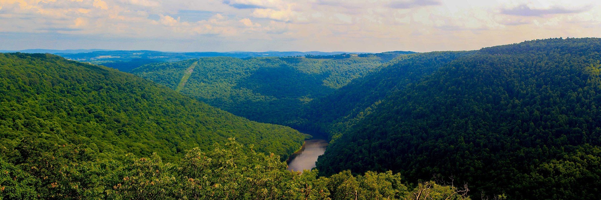
Coopers Rock State Forest covers 12,747 acres along the rim of the Cheat River Canyon, and the Coopers Rock hiking trails all begin within a couple of miles of the same I-68 exit east of Morgantown. The stone overlook stands about 1,200 feet above the river and sits a two-minute walk from parking, which is why it has always been the busiest patch of ground in the forest. It is currently closed for bridge replacement. That changes the shape of a day here. The canyon view is now something you walk to rather than drive to, and the trail network carries the traffic that used to stop at the railing.
West Virginia State Parks publishes a length and a difficulty rating for each trail here, and little beyond that. Elevation gain is not published for any of the six trails below, and the tread surface is described for only one of them — Ravens Rock, listed as access road and trail. So plan on the mileage and the rating, and expect ordinary Appalachian footing: rock, root and leaf litter over sandstone. The trails are open year round. The forest gate closes at 5 p.m., which is the most useful number to carry into the day, because it rules out late starts and most summer evenings.
Ravens Rock Trail, 1.5 miles to the canyon rim
Ravens Rock is the view to walk to while the main overlook is shut. The trail runs 1.5 miles, is rated moderate, and follows a mix of access road and trail out to a cliff edge above the Cheat River Canyon. The state publishes no elevation figure for it. Signage at the junction may read Ravens Rock rather than Raven Rock; it is the same place. Because it now stands in for a drive-up viewpoint, this trail draws far more foot traffic than a mile-and-a-half moderate walk normally would, and the parking nearest the trailhead fills on clear October weekends.
From the same rim, Rattlesnake Trail carries on along the canyon edge for another 0.7 mile, and almost nobody walks it. Add 0.7 mile in each direction and you get the canyon largely to yourself. Footing near any of these edges deserves care: bare sandstone polishes smooth under boots and turns slick when wet or iced, and there is nothing out here resembling the masonry wall at the main overlook. Children who are fine on a graded path are a different proposition on an unfenced clifftop. The state publishes a height for the main overlook — about 1,200 feet above the river — and nothing comparable for this rim, but the exposure is of the same order, and it is the reason to walk out here.
The two easy trails: Rock City and Virgin Hemlock
Rock City Trail is a mile, rated easy, and starts from Picnic Shelter #3. It is not a viewpoint walk. The route threads a boulder labyrinth — passages and crevices between house-sized sandstone blocks, in a forest that holds several hundred established boulder problems and draws climbers accordingly. Walking it takes longer than a flat mile suggests, because you spend the time looking up and squeezing through. The surface is not published, and it does not need to be: this is uneven ground among blocks, and the gaps hold water and ice well after the rest of the forest has dried out.
Virgin Hemlock Trail is 1.2 miles, also rated easy, and starts at WV 73. It runs through a hemlock grove more than 300 years old, which matters in a state that was almost entirely cut over — this is what the canyon rim looked like before the timber era, and there is very little of it left anywhere in West Virginia. The grove is dark, damp and quiet, several degrees cooler than the road. Neither of these two trails asks much of anyone, and between them they are the obvious pair for a short visit or for walking with children.
Clay Run Trail and the Henry Clay furnace
Clay Run Trail is 1.8 miles, rated moderate, and starts across the road from the entrance to the McCollum camping area. It ends at the Henry Clay iron furnace, a stone stack from the years when this forest was charcoal supply rather than recreation land. The mature woods you walk through to reach it are second growth over ground that was cut to feed that furnace. No elevation figure is published for the trail, and the surface is not described, so the moderate rating is the only guide to effort. At 1.8 miles it is the middle option in the forest: longer than the two easy walks, shorter than anything that needs a shuttle, and unlike the rim trails it has no exposure at all.
The furnace is a genuine destination rather than a plaque, and it is also a trail junction, which is what makes Clay Run more useful than its mileage suggests. Walking out to the stack and back is a straightforward couple of hours. Staying at the furnace and continuing on the trail that begins there turns it into a much longer day, described below. If you are camping at McCollum, this is the trail that starts at your door, which makes it the natural first walk of a weekend. The iron and charcoal history is also the best answer to why a forest this close to a city has this much unbroken second-growth timber on it: the land was worked hard, then left alone long enough to come back.
The long walks: Ken's Run and Mont Chateau
Ken's Run Trail is 4.5 miles and rated moderate — the longest single trail in the forest. It runs from the Sand Springs homestead to the archery range parking lot, so it is a point-to-point rather than a loop. Either shuttle two cars between the ends or accept that walking it out and back doubles the distance. The state publishes no elevation figure. This is the trail to choose when the aim is a long quiet walk in mature forest instead of a view, and it is the one place at Coopers Rock where you can spend most of a day without meeting the overlook crowd at any point.
Mont Chateau Trail is 2.6 miles, rated moderate to difficult, and begins at the Henry Clay iron furnace. It drops off the plateau to Cheat Lake near Mont Chateau — the lake is a 1,730-acre impoundment of the Cheat, 13 miles long, and this is the only trail in the forest that reaches it. The rating reflects the direction of travel: everything you descend on the way out has to be climbed on the way back. Linked with Clay Run at the furnace, it makes the longest continuous walk available here, and the return climb from lake level is the hardest hour of hiking in the forest.
When to walk them, and what to watch for
Hiking here is a year-round proposition. October is the reason most people come, when the hardwood on the canyon walls turns and the rim trails look their best; the same weekends bring the heaviest traffic the forest sees. Summer is humid and green, with the canyon view largely screened by leaf. Winter is the quietest season by a wide margin, the forest carries cross-country ski use, and the bare canopy is when the Cheat River Canyon is actually visible from the rim rather than glimpsed through it. Ice on exposed sandstone is the limiting factor rather than snow depth.
Two practical cautions apply to the Coopers Rock hiking trails in autumn. Hunting seasons across West Virginia overlap the best autumn hiking, and blaze orange is the standard practice on wildlife management areas, so check what applies where you are walking before opening weekend. And leaving the trail is harder here than it looks — rhododendron and mountain laurel make off-trail travel genuinely difficult, which is a reason to turn around at a junction rather than cut across. The gate closes at 5 p.m., and the main overlook remains closed for bridge replacement, so build the day around Ravens Rock.
Reach people planning this trip
Placement alongside guides for outfitters, guides, shops and lodging.
List your business hereQuestions
Is the Coopers Rock overlook open?
What is the longest trail at Coopers Rock?
How much elevation gain do the trails have?
Which trails are easy enough for young children?
What time does Coopers Rock State Forest close?
Which trail goes down to Cheat Lake?
Read next
 Best of
The Best Hikes in West Virginia
Thirty West Virginia hikes, from 400-foot overlook walks to the Dolly Sods traverse, ordered by effort rather than by fame.
11 min read
Destination · Mountaineer Country
Things to Do Outdoors in Morgantown, West Virginia
A survey of what a Morgantown base actually reaches: 48 miles of rail-trail, a 12,747-acre forest, Cheat Lake, new singletrack and the Cheat itself.
9 min read Guide · Mountaineer Country
The Mon River Rail-Trail System: A Complete Guide
How three trails make 48 miles of crushed limestone: the Caperton riverfront, the run north to Pennsylvania, and the 19-mile Deckers Creek climb.
8 min read · May