
Every organization we link to: local tourism offices, the state and federal agencies that manage the land, the nonprofits and clubs that keep access open, and the universities doing the research.
West Virginia has roughly 1.5 million acres of public land and a handful of places that carry almost all of the attention. The consequence is that a great deal of very good ground sits nearly empty, usually for one of three reasons: nobody has heard of it, the road in is gated or rough, or it is undeveloped and has nothing to advertise. Those are the places below — of them across regions.
Almost Heaven Swings
What makes a West Virginia hike different
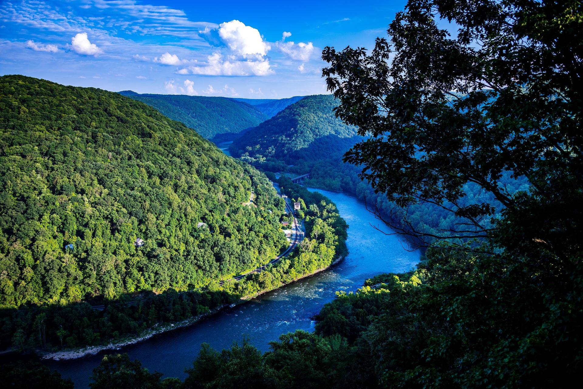
Almost nowhere in the state do you climb to a peak with a 360-degree view. What you get instead is a rim: you walk in on relatively level ground through hardwood or spruce, the trees open, and the land simply stops. That geology explains why so many of the state's greatest viewpoints are a short walk from a car, and why the few that demand a genuine climb — Maryland Heights, Loudoun Heights — are climbs of a thousand feet or more with no gentle version available.
It also explains the trail surfaces. Old railroad grades and logging roads run everywhere, which is why West Virginia has an unusual number of long, flat, scenic trails. The rocky, rooty, hand-over-hand hiking is concentrated in the wilderness areas of the Monongahela National Forest and along the sandstone rims of the New River Gorge.
The essential ten
If you only ever hike ten trails in West Virginia, these are the ten. They are ordered roughly by effort, not by quality.

Where the distances come from
Every mileage below is as published by the agency that manages the trail — the National Park Service, the Forest Service, or West Virginia State Parks. Where an agency does not publish a figure, none is given. Third-party trail apps frequently disagree with agency numbers, sometimes by a mile or more, and on federal wilderness trails in particular the crowd-sourced tracks are often following routes that are no longer maintained.
Elevation gain is the number that matters most here, and it is the one least often published. A 4.5-mile hike with 1,154 feet of gain, which is what Maryland Heights actually is, bears no resemblance to a 4.5-mile rail-trail walk.
Seasons, and the one that surprises people
Autumn is the obvious answer and it is the right one, with peak color moving down in elevation over roughly three weeks from the highlands to the Ohio Valley. The state publishes a live leaf map rather than fixed dates, which is the better approach — peak weeks move year to year and no one can predict them in August.
The underrated season is late winter into early spring. The leaves are off, which means views from trails that are enclosed in summer, and the waterfalls are running hard. What you trade is trail conditions: mud, ice on north-facing rock, and forest roads that are not maintained in winter. Forest Road 75 into Dolly Sods and WV 150 across the Highland Scenic Highway both fall into that category.
Summer is for water, not ridges. The state's swimming holes, tubing rivers and lake beaches are at their best exactly when the hiking is hottest and buggiest.
Before you go
Two practical warnings. First, mapping apps misroute badly in the New River Gorge — the Park Service says so explicitly on its own pages. Download the agency map rather than trusting a phone route to a trailhead. Second, hunting seasons overlap with prime autumn hiking. Blaze orange is cheap insurance from late October through December, and WVDNR publishes the current season dates.
Federal wilderness trails in the Monongahela are deliberately unblazed and unsigned. That is policy, not neglect. Dolly Sods in particular has a long record of experienced hikers getting turned around in fog on the plateau, where the trails braid and the landmarks look identical.
At a glance
Pinnacle Rock, Bramwell
400 feet, moderate. Stone steps to a viewing deck on a sandstone fin, directly off the Coal Heritage Trail. The most view per step in West Virginia.
Lindy Point, Blackwater Falls
A short walk to a railed ledge above the Blackwater Canyon. The most photographed sunset in the state — arrive early in October.
Grandview Rim, New River Gorge
A paved rim walk above the horseshoe bend of the New River, roughly 1,400 feet below. Continue past the main platform and the crowd disappears.
Beartown State Park
A boardwalk through a maze of eroded sandstone fissures. Under a mile, unlike anything else in the state, and most visitors have never heard of it.
Endless Wall, New River Gorge
Level walking through hardwood to Diamond Point, an open outcrop above the climbing cliffs. Park at Fern Creek; the Nuttall lot fills first.
Long Point, New River Gorge
3.2 miles round trip on old roadbed to a rock shelf facing the New River Gorge Bridge broadside. The bridge photograph is taken here.
Raven Rock, Coopers Rock
1.5 miles, moderate, to a cliff edge above the Cheat River Canyon. The alternative view while the main overlook is closed.
Seneca Rocks
A switchbacked climb to an observation platform below the quartzite fin. The summit itself is technical climbing only.
Maryland Heights, Harpers Ferry
4.5 miles round trip, 1,154 feet of gain, roughly 3.4 hours. No vehicle access, no easy version, and the definitive view of the town.
Dolly Sods, north to south
The state's signature traverse across heath barrens and wind-flagged spruce. Unblazed, exposed, and navigationally serious in fog.
Reach people planning this trip
Placement alongside guides for outfitters, guides, shops and lodging.
List your business hereQuestions
What is the single best hike in West Virginia?
Are West Virginia trails well marked?
When is the best time of year to hike in West Virginia?
Do I need bear spray?
Read next
 Best of
West Virginia Overlooks, Sorted by How Far You Walk
Every notable West Virginia overlook sorted by effort: drive-up terraces, 400-foot walks and full-day climbs, with gate hours and current closures.
9 min read Destination · Potomac Highlands
Hiking Dolly Sods
A practical guide to hiking Dolly Sods Wilderness: the main trails, route options, why it is navigationally serious, and how to reach Bear Rocks.
9 min read Best of · New River Gorge
The Best Hikes in New River Gorge National Park
Fifteen New River Gorge hikes ranked by what you get for the effort, with NPS distances, parking notes, and the one classic trail that is closed until 2027.
10 min read