
Every organization we link to: local tourism offices, the state and federal agencies that manage the land, the nonprofits and clubs that keep access open, and the universities doing the research.
Harpers Ferry National Historical Park
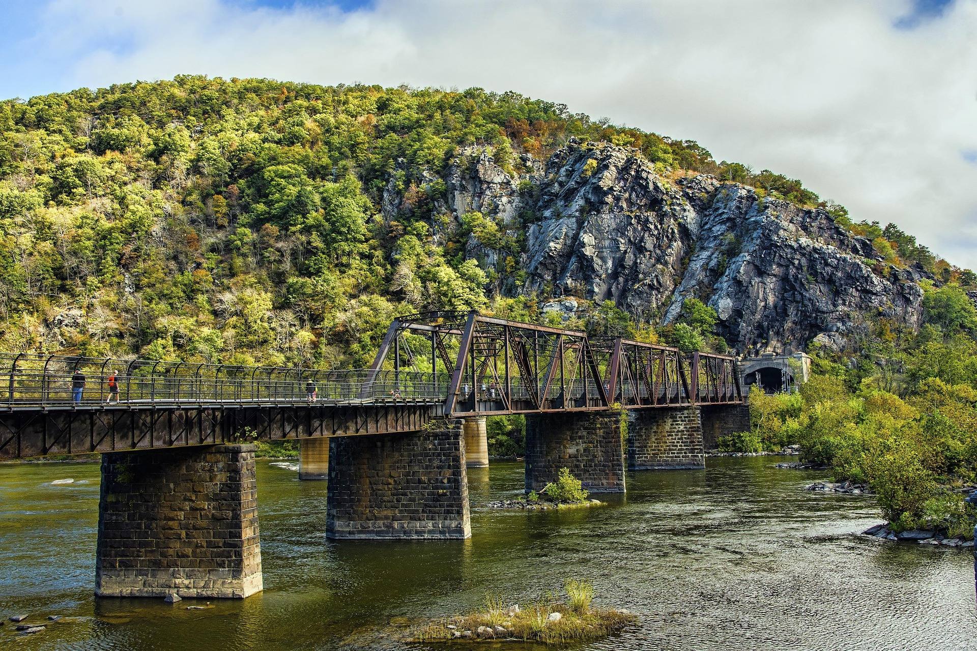
Where the Shenandoah meets the Potomac and three states meet at once, with the Appalachian Trail running straight through town and the Appalachian Trail Conservancy headquartered a block off Washington Street. Maryland Heights across the Potomac gives the classic overlook of the town and both rivers; Loudoun Heights and Jefferson Rock add more. Also the northern anchor for tubing, rafting and flatwater on both rivers.
Know before you go
- Maryland Heights is a steep 4 to 5 mile round trip to the overlook above the confluence
- Parking in town fills early — use the visitor center shuttle
- The C&O Canal Towpath runs along the Maryland bank for flat riding
- ATC headquarters keeps the thru-hiker photo archive and is free to visit
What you can do here
Maryland Heights is the walk people come for: a steep 4-to-5-mile round trip to the overlook above the confluence of the Shenandoah and Potomac. Loudoun Heights and Jefferson Rock add more overlooks, and the Appalachian Trail runs straight through town, covering about 24 miles in West Virginia. Park early or take the visitor center shuttle.
Local organizations
About 24 miles of the Appalachian Trail lie in West Virginia and the corridor runs through the middle of town, which makes this a resupply and rest point more than a trailhead. The Appalachian Trail Conservancy headquarters sits a block off Washington Street, is free to visit and keeps the thru-hiker photo archive. Shelter and camping rules along the corridor come from the ATC and the park.
Local organizations
Backpacking across West Virginia →Two rivers meet here, and the town is the northern anchor for tubing on both the Shenandoah and the Potomac. June through August is the season, when the water is warm and low enough to float. Parking in town fills early, so use the visitor center shuttle if you are basing here for the day.
Floats here
Local organizations
Maryland Heights gives the classic frame, the town below and both rivers joining, from a steep 4-to-5-mile round trip. Three states are visible at once from the high ground. Jefferson Rock and Loudoun Heights add more angles, and the C&O Canal Towpath along the Maryland bank puts you at water level. Morning fog in the river gap is the regional specialty.
Local organizations
Outdoor Photography across West Virginia →The Shenandoah and the Potomac both reach the town, and the park is the northern anchor for river recreation on the pair. April through October is the practical window for easy moving water. Access points, shuttle logistics and current flows are the things to sort out in advance, and town parking fills early, so the visitor center shuttle helps.
Local organizations
Flat water here means the gentler stretches of the Potomac and Shenandoah around the confluence, which the park lists alongside tubing and rafting. Both rivers change character with rainfall, so what is flat one week is not the next. Put-in and takeout arrangements are worth confirming with the park before you drive down.
Maryland Heights is the obvious hard effort, a steep 4-to-5-mile round trip with real climbing to the overlook. For flat, uninterrupted miles instead, the C&O Canal Towpath runs along the Maryland bank. The Appalachian Trail runs straight through town and covers about 24 miles in West Virginia. The visitor center shuttle solves the parking problem on busy mornings.
Guides, gear and lodging near Harpers Ferry National Historical Park
Place-level placement for operators within range of this trailhead, put-in or crag.
List your business hereNearby in the Eastern Panhandle
Cacapon Resort State Park
6,000 acres on Cacapon Mountain near Berkeley Springs, with a lodge, a Robert Trent Jones golf course, a lake beach and a trail system climbing to the 2,300-foot ridge.
Cacapon River
One of the finest gentle canoe rivers in the East — clear, shallow, warm and slow, winding through farmland and forest with reliable smallmouth fishing and easy multi-day trips.
Sleepy Creek Wildlife Management Area
Nearly 23,000 acres on Sleepy Creek Mountain — the largest WMA in the Eastern Panhandle, with a 205-acre lake, primitive camping, hunting, and a long ridge trail system.
Berkeley Springs State Park
The oldest spa in the country — warm mineral springs flowing at a constant 74°F that George Washington visited as a young surveyor.
Shenandoah & Potomac Rivers
The Shenandoah's Staircase rapids above Harpers Ferry give Class I–III whitewater in a resort-town setting, while the Potomac below the confluence spreads wide and slow for tubing and flatwater.
Trout Pond Recreation Area
Home to the only natural lake in West Virginia — a small sinkhole pond in the George Washington National Forest section of Hardy County, alongside the larger man-made Rockcliff Lake, a campground and trails into the Lost River State Forest country.
West Virginia has roughly 1.5 million acres of public land and a handful of places that carry almost all of the attention. The consequence is that a great deal of very good ground sits nearly empty, usually for one of three reasons: nobody has heard of it, the road in is gated or rough, or it is undeveloped and has nothing to advertise. Those are the places below — of them across regions.