
Every organization we link to: local tourism offices, the state and federal agencies that manage the land, the nonprofits and clubs that keep access open, and the universities doing the research.
West Virginia has roughly 1.5 million acres of public land and a handful of places that carry almost all of the attention. The consequence is that a great deal of very good ground sits nearly empty, usually for one of three reasons: nobody has heard of it, the road in is gated or rough, or it is undeveloped and has nothing to advertise. Those are the places below — of them across regions.
Almost Heaven Swings

The twelve you can reach without a hike
Every overlook on this site is rated by how far you walk from the car. Twelve are drive-ups: Grandview Main Overlook, Hawks Nest Overlook, Sandstone Falls Overlook, Pendleton Point Overlook, Bear Rocks Preserve, the Spruce Knob Observation Tower, the Seneca Rocks Viewing Area, Bald Knob, the Highland Scenic Highway overlooks, Coopers Rock Main Overlook, Cacapon Mountain Overlook, and the Bolar Lookout Tower at Pipestem.
Drive-up describes the walk, not the drive. Six of the twelve carry an access caution, and West Virginia roads follow creeks and ridges rather than straight lines, so sixty road miles can take two hours. Check real drive times rather than estimating from a map.
The six with no caution attached are Grandview, Hawks Nest, Sandstone Falls, Pendleton Point, the Seneca Rocks Viewing Area and the Bolar Lookout Tower. Those are the short-notice options.
Two drive-ups a car alone will not deliver
Coopers Rock Main Overlook is closed for bridge replacement with no announced reopening date. The record is direct: do not plan a trip around it. Raven Rock, a 1.5-mile moderate day hike in the same state forest, is the view to walk to instead.
Bald Knob is reached by scheduled train only. No self-driving option appears, and the run is not offered every day, so the railroad's timetable settles whether the trip exists at all.
The Bolar Lookout Tower at Pipestem is a straightforward drive-up, but the surrounding operation is seasonal. The Canyon Rim Center runs on a season, and so does the aerial tram into the gorge that reaches the park's lower lodge. Verify both before building a day around them.
Four drive-up roads that close or go unmaintained
Winter thins this list faster than anything else. Forest Road 75 to Bear Rocks Preserve is unpaved, rough and not winter-maintained, and it is the forest road this site's driving reference singles out statewide as hard on a low car. The Spruce Knob summit road is likewise unmaintained in winter.
WV 150, the Highland Scenic Highway, is not winter-maintained and closes to through traffic under snow. Upslope snowfall in Tucker, Preston and Pocahontas counties routinely produces accumulations nothing else in the mid-Atlantic matches, so treat a snow-season plan there as provisional.
Cacapon Mountain Overlook reverses hardest. The mountain road closes in winter but stays open to foot traffic, turning a drive-up into a four-mile walk. Call the park before a cold-season trip, since no closing and opening dates are published.
Seven short walks, three with a published distance
Short walks cover Turkey Spur Rock, Island in the Sky, Lindy Point, Jefferson Rock, Pinnacle Rock, the Stonewall Resort Overlook, and the Tomlinson Run Valley Overlook. These need legs but not a hike.
Three carry figures. Pinnacle Rock is 400 feet and rated moderate, short and still steep enough to be graded. The Stonewall Resort Overlook is 0.7 miles and easy. Jefferson Rock needs reading before you go: the rock itself is unstable, climbing on it is prohibited, and the historic stone steps are irregular and not accessible.
No distance or grade is published for Turkey Spur Rock, Island in the Sky, Lindy Point or Tomlinson Run Valley. If the exact length decides the trip, ask the managing park.
The ten that are genuine day hikes
By published distance: Panther State Forest Overlook at 0.75 miles and rated difficult, Raven Rock at 1.5 miles, Overlook Rock in Kanawha State Forest at 1.5 miles, Beech Fork Overlook at 2 miles, Still Run Ridge at Twin Falls at 2.5 miles, Long Point at 3.2 miles round trip, Maryland Heights Overlook at 4.5 miles round trip, and Split Rock on Loudoun Heights at up to 7.5 miles round trip.
The two longest carry gain figures: 1,154 feet to Maryland Heights and 1,377 feet to Split Rock. Maryland Heights has no vehicle access at all, the National Park Service rates the shortest route moderate at roughly 3.4 hours, and bridge work has disrupted the approach, so check with the NPS first.
Diamond Point and Cranny Crow Overlook have no published distance. Two others need a caveat instead of a number: the Panther State Forest overlook structure no longer exists, though the view from the outcrops does, and an internal forest bridge near the Overlook Rock trailhead in Kanawha State Forest is closed to all traffic, which changes circulation there.
None of the state park overlooks charge admission
West Virginia charges no entrance fee at any of its 35 state parks or 9 state forests. The policy is set in state code, so day use costs nothing and fees attach only to camping, cabins, lodge rooms, pools, golf and rentals.
Federal ground is not uniform. A handful of national forest recreation areas and Corps of Engineers day-use areas charge a modest fee at a gate or by envelope, and the America the Beautiful pass covers those. Sites on state park land keep park hours, which is the constraint that bites at sunrise and sunset.
Many Almost Heaven Swings sit at state park and state forest overlooks. They are free, unstaffed and first come first served, most a short walk from parking though a few need a modest hike. The roster changes, so confirm a specific one on the Department of Tourism map before driving for it.
Season, light and blaze orange
Nine overlooks have a time of day attached. Sunrise belongs to Grandview, Island in the Sky and Bear Rocks. Sunset belongs to Long Point, Lindy Point, Pendleton Point, the Highland Scenic Highway overlooks and Still Run Ridge. Pinnacle Rock is listed for either; for the other twenty, no time is published.
Fall color starts on the highest ridges in late September and works downhill through late October, reaching the Ohio Valley last, so altitude matters as much as the calendar. September and October are the busiest weeks of the year, and lodging in Fayetteville, Davis and Marlinton books months ahead. November and December trade color for open sightlines: leaves down, wider views, empty trails.
That quiet season overlaps hunting season. Wear blaze orange from October through January on public land outside state parks, and put orange on a dog. State forests permit hunting where parks generally do not, which covers the Panther, Kanawha and Coopers Rock overlooks here.
Reach people planning this trip
Placement alongside guides for outfitters, guides, shops and lodging.
List your business hereQuestions
Do you have to pay to visit West Virginia overlooks?
Which West Virginia overlooks can you drive right up to?
Is Coopers Rock main overlook open?
Which drive-up overlooks are affected by winter?
Read next
Best of
West Virginia Overlooks, Sorted by How Far You Walk
Every notable West Virginia overlook sorted by effort: drive-up terraces, 400-foot walks and full-day climbs, with gate hours and current closures.
9 min read Guide · Greenbrier Valley
The Highland Scenic Highway: Driving and Hiking
A 43-mile byway above 4,500 feet: four overlooks, the Cranberry Glades boardwalk, the Falls of Hills Creek, and the trailheads that close all winter.
7 min read · October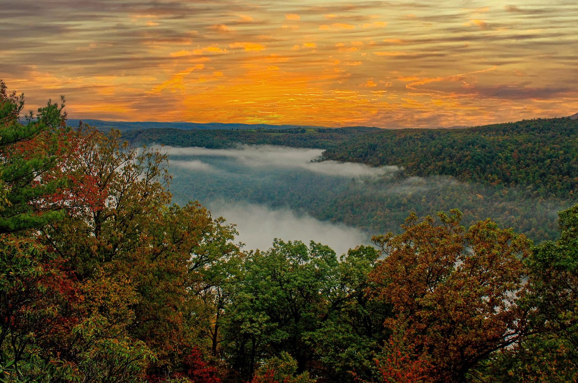 Destination · Greenbrier Valley
Cass Scenic Railroad and Bald Knob
Shay steam up the original logging grades to Bald Knob at 4,842 feet: the 4.5-hour run, what to wear, the company houses, and the trail that starts here.
7 min read · September