
Every organization we link to: local tourism offices, the state and federal agencies that manage the land, the nonprofits and clubs that keep access open, and the universities doing the research.
West Virginia has roughly 1.5 million acres of public land and a handful of places that carry almost all of the attention. The consequence is that a great deal of very good ground sits nearly empty, usually for one of three reasons: nobody has heard of it, the road in is gated or rough, or it is undeveloped and has nothing to advertise. Those are the places below — of them across regions.
Almost Heaven Swings

A sandstone fin standing above the highway
Pinnacle Rock State Park is 400 acres in Mercer County, and one feature carries the place: a jagged sandstone fin that rises above the highway, with its top published at 3,100 feet. A stairway runs up it. That stairway is the reason the park exists as a stop, and the view from the top looks out over the southern coalfields.
The park is day use only. No camping is offered, which settles the shape of a trip before you start planning one: you arrive, you climb, you look, and you drive on to wherever you are sleeping. Treat it as a scheduled stop inside a longer day rather than a destination that fills one.
Below the fin lies Jimmy Lewis Lake, the park's water and its second reason to pull off. Between the rock and the lake, the record describes a compact day-use park rather than a network of trails and facilities.
The stair climb, and what the park does not publish about it
The state's description of the climb is that it is short but steep. That is the whole of the published difficulty rating, and it is worth taking at face value: stairs on a sandstone fin gain height fast in a small footprint.
No stair count, vertical gain, surface description or handrail detail appears in this record. If a knee, a stroller or a mobility limit decides whether the climb is possible for someone in your group, that question cannot be answered from published park material. Ask West Virginia State Parks through wvstateparks.com, or call the park office, before you commit anyone to it.
What waits at the top is a view over the southern coalfields from 3,100 feet. The park record does not break that view into named ridges or landmarks, so go up expecting an open outlook over mined and forested country rather than a labeled panorama.
Fishing Jimmy Lewis Lake
Jimmy Lewis Lake sits below the rock and is described as small-water fishing. That points at bank work and short casts rather than a boat program, and the day-use rule means no dawn-to-dark session: an afternoon on the bank is the realistic outing.
Nothing about species or stocking is published for this lake in the park record. Anyone driving specifically to fish it should confirm with the West Virginia Division of Natural Resources what, if anything, goes in and when. State fishing licenses apply, and the park may carry its own bank or access rules on top of them, so ask the park office as well.
Timing the light and the color
Two conditions make the overlook worth planning around rather than passing through. Valley fog in the morning fills the low ground below the fin and separates the ridges. Hardwood color in fall does the same job with tone instead of depth.
Both of those argue for early or late arrival, and the day-use rule is the constraint. Closing hours are not given in this record, so if you intend to shoot last light, verify the gate time with West Virginia State Parks first. A short steep stairway is a poor place to be surprised by a closing park.
Where the park fits in the New River Gorge region
This is New River Gorge country. The New has cut a gorge roughly 1,000 feet deep through Nuttall sandstone, protected since 2020 as New River Gorge National Park and Preserve, with 53 miles of the river under protection. The cliff bands above it hold more than 1,600 established climbing routes, the largest concentration of sandstone climbing in the eastern United States.
Immediately north, the Gauley River runs on scheduled autumn dam releases out of Summersville Lake, which is why the region's fall calendar is built around water as much as color. A day-use overlook in Mercer County pairs naturally with that kind of trip: it is the sort of stop you make between a river day and a drive.
Drive times and distances between Pinnacle Rock and those places are not published in this record. Work them out from a map rather than from this page.
Planning a visit around a small park
Because nothing longer than the stairway is published here, the honest plan is to build the day elsewhere and slot the rock in. The park supports a climb, a view, and time on the bank at Jimmy Lewis Lake. It does not support a full hiking day, and it cannot host an overnight.
Before you go, three things are worth a phone call: closing hours, whether the stairway is open and in condition, and current rules for fishing the lake. All three are administered by West Virginia State Parks, with licensing handled by the Division of Natural Resources. None of them are answered by the material this page is built from.
Reach people planning this trip
Placement alongside guides for outfitters, guides, shops and lodging.
List your business hereQuestions
How high is Pinnacle Rock in West Virginia?
Can you camp at Pinnacle Rock State Park?
What fish are in Jimmy Lewis Lake?
How hard is the hike to the top of Pinnacle Rock?
Read next
 Best of
West Virginia Overlooks, Sorted by How Far You Walk
Every notable West Virginia overlook sorted by effort: drive-up terraces, 400-foot walks and full-day climbs, with gate hours and current closures.
9 min read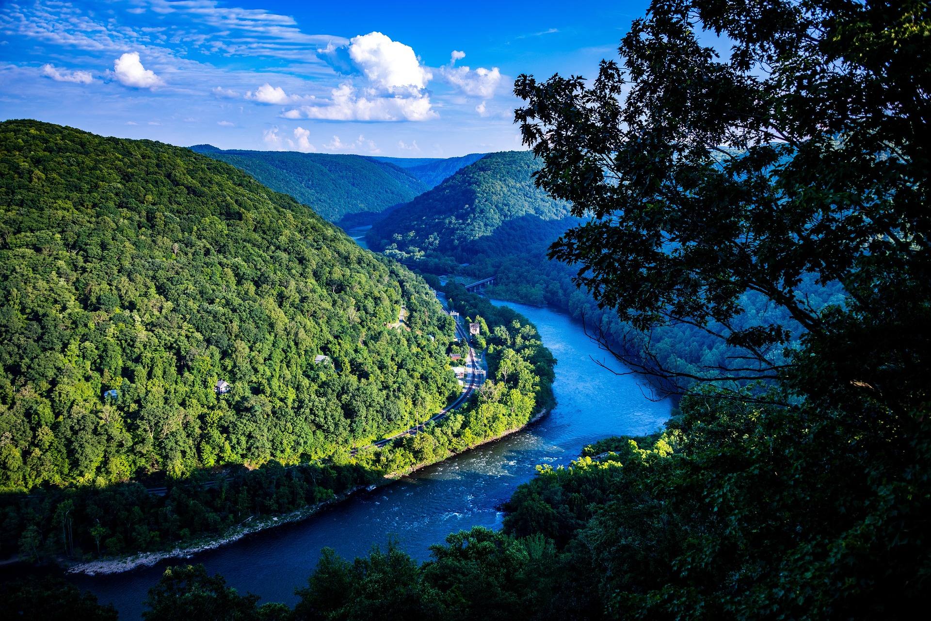 Destination · New River Gorge
Things to Do Outdoors in Beckley, West Virginia
Grandview's rim views, Little Beaver's trail network, river access off WV 41 and the late-May rhododendron — the outdoors within reach of Beckley.
6 min read Guide
Guide
West Virginia Fall Foliage Guide
Where and when to see fall foliage in West Virginia: how color moves down in elevation, the best overlooks and drives, and why peak dates shift.
9 min read · October