
Every organization we link to: local tourism offices, the state and federal agencies that manage the land, the nonprofits and clubs that keep access open, and the universities doing the research.
West Virginia has roughly 1.5 million acres of public land and a handful of places that carry almost all of the attention. The consequence is that a great deal of very good ground sits nearly empty, usually for one of three reasons: nobody has heard of it, the road in is gated or rough, or it is undeveloped and has nothing to advertise. Those are the places below — of them across regions.
Almost Heaven Swings

Watoga State Park hiking, by the park's own figures
Watoga State Park hiking covers 10,100 acres above the Greenbrier River, and the trail network divides cleanly by effort. West Virginia State Parks rates most of the named trails moderate to difficult, publishes a climb of more than 1,000 feet onto Workman Ridge, and carries 5.5 miles of the Allegheny Trail through the park. The park was built largely by the Civilian Conservation Corps in the 1930s, which shows in the trail construction — old roadbeds and graded benches rather than modern contour singletrack. The park does not publish an elevation-gain figure for most individual trails, so the difficulty rating is the number to plan around.
The layout is simple enough to hold in your head. The lake sits at the center with the one flat walk around it, the lookout tower sits on the high ground with two very different trails going up to it, and the long lines run north-south — the Allegheny Trail across the park and the Greenbrier River Trail along the river below. South of the park boundary, Calvin Price State Forest covers 9,482 undeveloped acres, which is where the trail network turns into real backcountry with no facilities and minimal marking.
Jesse's Cove Trail — 2.5 miles, moderate to difficult
Jesse's Cove is the hike that shows you why the park is where it is. The state park gives it as 2.5 miles with a climb of more than 1,000 feet, rated moderate to difficult, running down along the Greenbrier River to the mouth of Rock Run and then up Rock Run onto Workman Ridge. That structure — down first, then a sustained climb out — is the thing to understand before you start. The easy part is at the beginning, and the 1,000 feet is waiting for you on the way back toward the ridge.
For its length it is the most work in the park, and the most rewarding stretch of it is the run up Rock Run, where a small stream cuts through hardwood on limestone country and the sound follows you the whole way up. Two and a half miles with that much climb reads as a half-day rather than an after-lunch stroll, particularly in summer humidity. The park does not publish a surface description for it, so treat it as a foot trail: creek crossings and leaf litter, not gravel, and slower going after rain than the mileage suggests.
The Arrowhead and Ann Bailey trails to the lookout tower
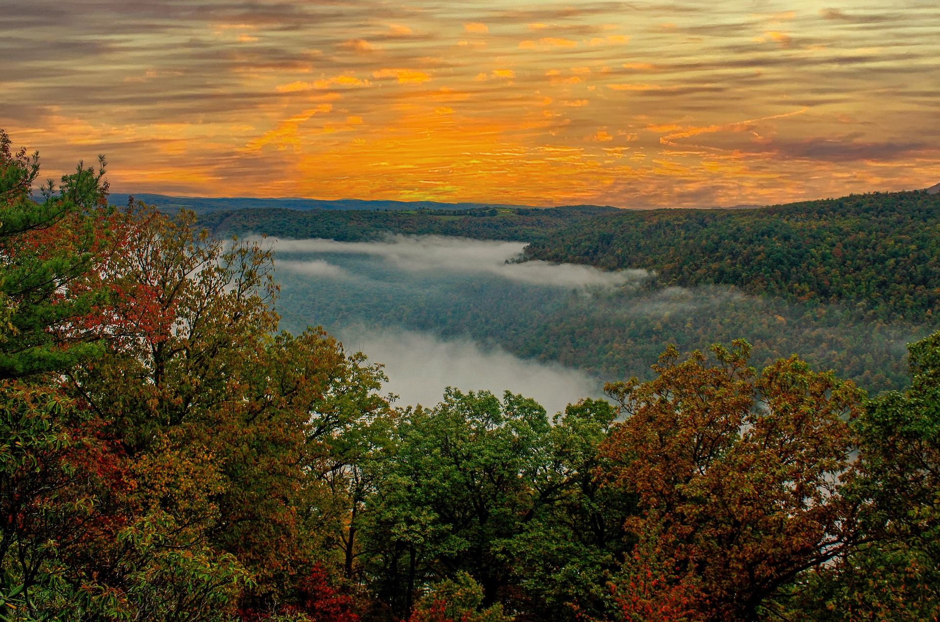
The Ann Bailey Lookout Tower gives the best view in the park, and the park publishes two trails to it with very different characters. The Ann Bailey Trail is 3 miles, rated moderate to difficult, crossing Pyles Mountain and Workman Ridge on an old roadbed where mountain bikes are welcome. Because it is a roadbed, the footing is broad and the grade is steady, which makes it the choice for anyone who would rather trade distance for pitch — or who wants to ride up instead of walk. Three miles of that on the way out is a straightforward morning.
The Arrowhead Trail is the other option: 1 mile, rated difficult, and described by the park as the short steep way to the tower and the Greenbrier River Valley view. A mile rated difficult means what it sounds like. The obvious combination is up the Arrowhead and down the Ann Bailey, which spreads the descent out over three miles of roadbed instead of dropping it all onto your knees in one. The park does not publish gain figures for either trail, so the ratings — difficult for the short one, moderate to difficult for the long one — are the honest guide.
The tower is also the reason to time a hike late. Watoga has been an International Dark Sky Park since 2021, and open high ground at the end of a mile-long climb is a different proposition after sunset than at noon. Hunting is not permitted inside the park, which makes autumn evenings here easier to plan than in the surrounding national forest and state forest land. Watoga is the state's center of gravity for dark-sky programming, and the name comes from a Cherokee word meaning starry waters. Carry a light for the walk down: a trail the park rates difficult in daylight is the same trail in the dark.
Lake Trail — 1.5 miles, easy
The Lake Trail is the one flat walk in the park: 1.5 miles, rated easy, circling Watoga Lake, with trailheads at the boat docks, the dam and the pool parking lot. Three trailheads on a 1.5-mile loop means you can start it from wherever you parked and shorten it at will, which makes it the trail for a first evening, a rest day between climbs, or anyone in the group who is not doing Jesse's Cove. The park's pages give the lake as 11 acres in one place and 12 in another.
The lake itself is electric trolling motors only — gasoline motors are prohibited — so the water beside the trail stays quiet. Boat rentals run Memorial Day to Labor Day. Along with the arboretum, this is the part of Watoga that works for a family with mixed appetites for effort, and it is the only trail here that the park rates easy, which is worth knowing before you send someone out on a trail described as moderate to difficult. It also doubles as the walk you do at the end of a long day, when the climbs are done and you want a mile and a half of level ground beside water.
The Allegheny Trail through the park, and Calvin Price beyond
Watoga carries 5.5 miles of the Allegheny Trail, rated moderate to difficult, and the park describes it as part of the backpack route running from its northern terminus near Blackwater Falls to the Virginia border. That gives Watoga something few state parks have: a through-hike segment you can walk as a day hike, or use as the start of something much longer. Rated moderate to difficult across 5.5 miles, it is the longest continuous single line inside the park boundary and the natural objective for a strong day of Watoga State Park hiking.
The trail network connects into Calvin Price State Forest to the south for real backcountry. Calvin Price has no campground and no cabins — backcountry use only, minimal trail marking, and 9,482 acres managed primarily for timber, wildlife and hunting. Access is easiest through Watoga. Take a map and compass, expect no signage, and be aware that hunting is permitted there even though it is not permitted in the park. Rhododendron and mountain laurel make travel off the trail slow and sometimes impossible, which is the practical limit on improvising a route.
October, the river trail below, and where to sleep
October is the month people plan around here. The hardwood turns, the humidity that makes the Workman Ridge climb hard in July is gone, and the park's dark-sky designation makes a clear night worth staying up for. It is also hunting season on the surrounding land — not inside the park, but on the forest and state forest ground around it — so blaze orange belongs in the pack if any part of the day crosses out of Watoga. Cold comes early at this elevation, and the climbs that felt punishing in August are the reason to come in the first week of good color.
The flat option on a day when nobody wants to climb is the Greenbrier River Trail below the park, which the state rates easy and gives as 78 miles from Cass to Caldwell, with 1,696 feet at the southern end, trailside camping shelters at intervals and a grade that never exceeds about one percent. It is the one line here you can walk for hours without climbing. Down the valley, Droop Mountain Battlefield State Park has short, easy trails that an hour covers, and a tower view over the Greenbrier Valley.
For lodging, Beaver Creek campground has 38 sites and Riverside 50, all on 50-amp electric, and weekend stays need a two-night minimum. Cabins book roughly a year ahead, which is the single most useful fact on this page for anyone planning an October trip. If the cabins are gone, the campgrounds are the fallback inside the park, and Calvin Price is the option for anyone equipped to camp with no facilities at all. Two nights is the right length anyway: one for the tower and Jesse's Cove, one for the Allegheny Trail and the flat miles by the river, with the arboretum and the lake filling the gap.
Reach people planning this trip
Placement alongside guides for outfitters, guides, shops and lodging.
List your business hereQuestions
What is the hardest hike in Watoga State Park?
How long is the trail around Watoga Lake?
What is the best hike for a view in Watoga?
Can you hike the Allegheny Trail in Watoga State Park?
How much elevation gain do Watoga's trails have?
Is hunting allowed in Watoga State Park?
Read next
 Destination · Greenbrier Valley
The Greenbrier River Trail
A guide to the Greenbrier River Trail: trailheads, camping, bikepacking it end to end, tubing alongside it, and the best sections for a day out.
8 min read Destination · Greenbrier Valley
Things to Do Outdoors in Lewisburg, West Virginia
A survey of the outdoor options around Lewisburg: the rail-trail at Caldwell, Kate's Mountain, Blue Bend, summer tubing water, and the wet-weather backups.
7 min read
Destination · Greenbrier Valley
Things to Do in Marlinton, West Virginia
What to do from Marlinton: the rail-trail at mile 56, Tea Creek's 44 miles of trail, Seneca State Forest, smallmouth water, and what closes in winter.
6 min read