
Every organization we link to: local tourism offices, the state and federal agencies that manage the land, the nonprofits and clubs that keep access open, and the universities doing the research.
West Virginia has roughly 1.5 million acres of public land and a handful of places that carry almost all of the attention. The consequence is that a great deal of very good ground sits nearly empty, usually for one of three reasons: nobody has heard of it, the road in is gated or rough, or it is undeveloped and has nothing to advertise. Those are the places below — of them across regions.
Almost Heaven Swings
Elevation is the variable that actually changes
Four places on this site have records that speak to late-summer conditions, and all four sit in the Potomac Highlands on high ground. Kumbrabow is the highest state forest in West Virginia. Spruce Knob is the state high point at 4,863 feet and the high point of the entire Allegheny range. Dolly Sods Wilderness occupies a plateau largely above 4,000 feet. Blackwater Falls State Park holds an eight-mile canyon and an overlook the park puts at 3,000 feet.
Only one of those records uses the word cool outright, and that is Kumbrabow. The other three are described by elevation, forest type and exposure rather than by temperature. No temperature figures or valley-to-ridge comparisons are published for any of them, so read this as a guide to where the high ground is, not as a forecast.
Spruce is the marker in all four records: red spruce and northern hardwood on Rich Mountain, wind-flagged spruce on the Spruce Knob summit loop, wind-flagged red spruce and sphagnum bog on the Sods plateau, and hemlock and spruce tannins staining the Blackwater River amber.
Kumbrabow is the one record that says cool in August
The Kumbrabow record is direct: 9,474 acres of red spruce and northern hardwood on Rich Mountain, the highest state forest in the state, cool even in August, and almost nobody there. That emptiness is a function of access. The forest roads are gravel and the record notes they can be rough.
Cabins are described as rustic, and cold-season use requires wood heat. How many there are, what they cost, and when they open and close is not published here, so book through West Virginia State Parks at wvstateparks.com. The same applies to the campground and primitive sites listed among the forest's activities.
Mill Creek is native brook trout water, fished with light tackle and small flies. No stocking schedule, creel limit or access mileage appears in the record, so confirm current regulations with the state before you drive up to fish.
Spruce Knob reaches 4,863 feet without a climb
A road runs to the summit of Spruce Knob, paved but with a long winding approach. That matters in August: you can stand at the highest point in the state in walking shoes.
At the top, Whispering Spruce Trail 567 loops a half mile through wind-flagged spruce past an observation tower. The summit is frequently in cloud, and the record's advice is to check the forecast for the ridge rather than the valley. Cloud on the knob is the ordinary case, not the unlucky one.
Below the summit, Spruce Knob Lake offers trout fishing and a small campground, and Spruce Knob Lake Trail 575 circles the lake in a mile on the forest roads. No site count, fee or reservation system for that campground is published; the Monongahela National Forest is the agency to ask. The surrounding national recreation area also holds the Seneca Creek backcountry.
Dolly Sods is cool and exposed at once
Dolly Sods is 17,371 acres of federally designated wilderness on a plateau largely above 4,000 feet, and its openness is the result of damage. The original spruce forest was logged and the remaining duff burned to bedrock in the early twentieth century. High ground with almost no canopy is a different proposition in August than shaded high ground.
Two hazards here have nothing to do with heat. The area served as a live-fire artillery training range during World War II, and unexploded ordnance warnings are still posted at trailheads. Trails are unblazed, junctions unsigned and stream crossings unbridged, so navigation is a requirement. There are 47 miles of trail in all: Red Creek 6.4 miles, Blackbird Knob 4.7, Rohrbaugh 3.6.
Water is the planning problem. There is no potable water anywhere in the wilderness. Red Creek runs tannin-brown and crossings can be impassable after rain. Weather changes fast and the record flags hypothermia as a real risk in any month, August included. Camp on durable surfaces only, since the bogs recover slowly; camping is prohibited within 300 feet of Forest Roads 19 and 75 except at Red Creek Campground. Bear Rocks at sunrise means arriving in the dark.
Blackwater Falls trades altitude for canyon shade
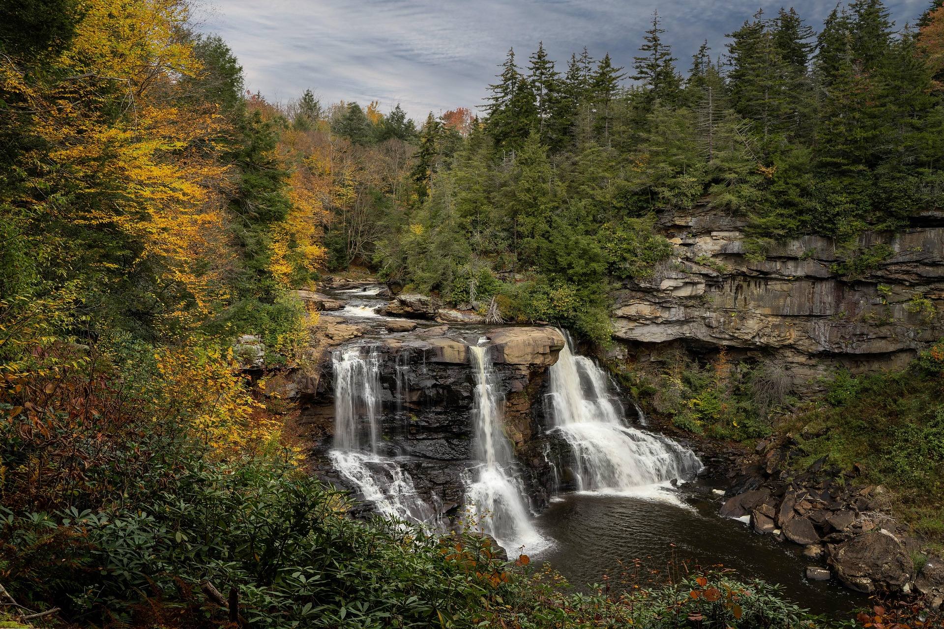
This park works differently from the other three. A 57-foot falls drops into an eight-mile canyon, the water amber from hemlock and spruce tannins, and the canyon gives shade that open plateau cannot.
Boardwalk and stairs reach several viewing platforms. The boardwalk is a quarter mile with more than 200 steps down, the part people underestimate on a warm day. The Gentle Trail is the paved quarter-mile alternative for anyone who cannot manage stairs. Elakala Falls is a five-minute walk from the lodge and, per the record, often overlooked.
Pendleton Point Overlook gives the deepest canyon view, and Lindy Point ends at an overlook the park puts at 3,000 feet. The park's descriptions of Lindy Point do not agree: one calls it a short flat walk best at sunset, another gives 0.3 miles rated moderate to difficult. Assume the harder version. Of 21 trails, River Road Trail runs 1.56 miles on an old railroad grade and links the park to Davis.
What these records do not publish, and who to ask
No temperature or seasonal average appears anywhere in these four records, so nobody should quote this page a number. Fees, hours, opening and closing dates, cabin counts and campsite counts are absent as well. Drive times and distances between the four are unpublished, so plan the driving from a map.
Two agencies hold the rest. Kumbrabow State Forest and Blackwater Falls State Park are West Virginia State Parks properties, at wvstateparks.com. Spruce Knob and Dolly Sods sit in the Monongahela National Forest, at fs.usda.gov/mnf, which is the office for forest road conditions and anything signed at a Sods trailhead.
Swimming deserves one flat statement: none of the four records list it as an activity, so ask the managing agency rather than assuming. What the records do give you is what each stop asks. Kumbrabow asks tolerance of rough gravel. Spruce Knob asks a long approach and the acceptance that you may arrive inside a cloud. Dolly Sods asks navigation, carried water and clothing for weather that turns. Blackwater Falls asks the least.
Reach people planning this trip
Placement alongside guides for outfitters, guides, shops and lodging.
List your business hereQuestions
what is the coolest place in west virginia in summer?
how high is spruce knob and can you drive to the top?
is there drinking water in dolly sods?
can you swim at blackwater falls state park?
Read next
 Destination · Potomac Highlands
Hiking Dolly Sods
A practical guide to hiking Dolly Sods Wilderness: the main trails, route options, why it is navigationally serious, and how to reach Bear Rocks.
9 min read Guide · Potomac Highlands
Hiking Spruce Knob, the Highest Point in West Virginia
Walking West Virginia's 4,863-foot high point: the half-mile summit loop, the lake circuit, the ridge trails below, and the weather to plan around.
7 min read · August
Destination · Potomac Highlands
Blackwater Falls State Park
A complete guide to Blackwater Falls State Park: every waterfall and overlook, Lindy Point at sunset, the trails, lodging and the best season to visit.
8 min read · October