
Every organization we link to: local tourism offices, the state and federal agencies that manage the land, the nonprofits and clubs that keep access open, and the universities doing the research.
West Virginia has roughly 1.5 million acres of public land and a handful of places that carry almost all of the attention. The consequence is that a great deal of very good ground sits nearly empty, usually for one of three reasons: nobody has heard of it, the road in is gated or rough, or it is undeveloped and has nothing to advertise. Those are the places below — of them across regions.
Almost Heaven Swings
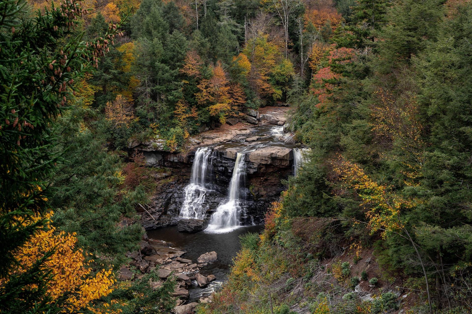
What the Blackwater Canyon Trail is
The Blackwater Canyon Trail is ten miles of former railroad grade running from Thomas, at the top of the canyon, down to Hendricks at the bottom. It drops through hemlock, passes waterfalls, and keeps the Blackwater River below it. The surface is gravel and the grade is gentle, which is the combination that makes this one of the best introductory backcountry rides or runs in the Highlands: nothing technical, nothing to route-find, and moving water in earshot most of the way. What it is not is symmetrical. The trail runs downhill from north to south, so the direction you pick shapes the day far more than your fitness does.
Published information on this trail comes from Save Blackwater rather than a state park page or a ranger district office, which is worth knowing when you go looking for a conditions report before you drive. West Virginia's rail-trail inventory is one of the best per capita in the country, and on rail-trails generally the grade rarely exceeds two percent, which is why old railroad beds in this state get handed to people who have never ridden off pavement. TrailLink and the West Virginia Rails-to-Trails Council keep the fullest inventories of the others. This one sits at the rough end of that catalog: unpaved, coarse underfoot, and set in a canyon rather than along a river flat.
Where the trail begins and ends
Thomas sits at the top end and Hendricks at the bottom, and the guidance that comes with the trail is to ride it downhill from Thomas with a shuttle arranged at the far end. That is the whole plan: a vehicle left at Hendricks, a start at Thomas, ten miles of descending gravel in between. Douglas Falls, near the top end, is a short detour off the grade and worth taking early, while you still have the legs and the light for it. Nothing about the trail requires the shuttle, but everything about it is easier with one.
Without a second vehicle the trip becomes an out-and-back, which means the same ten miles climbed on the return — still gentle, still gravel, but a different afternoon than the one people describe when they recommend this ride. On foot an out-and-back is more reasonable, because most walkers turn around well before Hendricks anyway, and Douglas Falls and the upper canyon are at the Thomas end where they start. Riders who want the descent without the logistics sometimes ride down and arrange a lift back by road, which depends entirely on who they came with.
What the surface demands
The published caution about this trail is about tires: the surface is rough gravel, and you want something wider than a road tire under you. A gravel bike handles it. A mountain bike handles it with room to spare, which matters more on the descent than on the flat, since ten miles of loose surface going downhill is ten miles of braking on a surface that does not reward hard braking. Narrow tires will get down, but they will make you concentrate the entire way rather than look at the canyon you came to see.
The trail is listed for gravel biking, mountain biking, hiking, trail running and cross-country skiing, and that range says something about the tread: firm enough to run on, loose enough to be careless on. There are no tunnels to light and no pavement anywhere along it. Rain does not close the grade, but a gravel railroad bed after a wet week collects water in the low spots and runs slick where the surface has been worn smooth, and the canyon walls hold shade well into the morning, so what dried out up on the rim has not necessarily dried out down here.
Walking, running and skiing it
On foot, ten miles of railroad grade goes faster than ten miles of mountain trail, which is why this route turns up in the trail-running column as often as the hiking one. Runners get the same asymmetry the cyclists get: north to south is one long descent, and the return is a long, even climb with no relief in it. Hikers more often treat the Thomas end as the destination rather than the corridor, walking in as far as Douglas Falls and back out, which puts the waterfall and the canyon in a half day and needs no car shuffle at all.
The trail is also listed for cross-country skiing, and in this part of the state conditions are elevation-dependent enough that a bare road in town tells you nothing about what is lying on the grade. A railroad bed is the friendliest surface to ski in the region, because the gradient never changes and the corridor stays wide, but nobody grooms this one. What you get is what fell and what has been skied since, and after a thaw and a refreeze a ten-mile descent on a gravel grade becomes a faster, firmer proposition than it looks on the map.
The falls end of the canyon
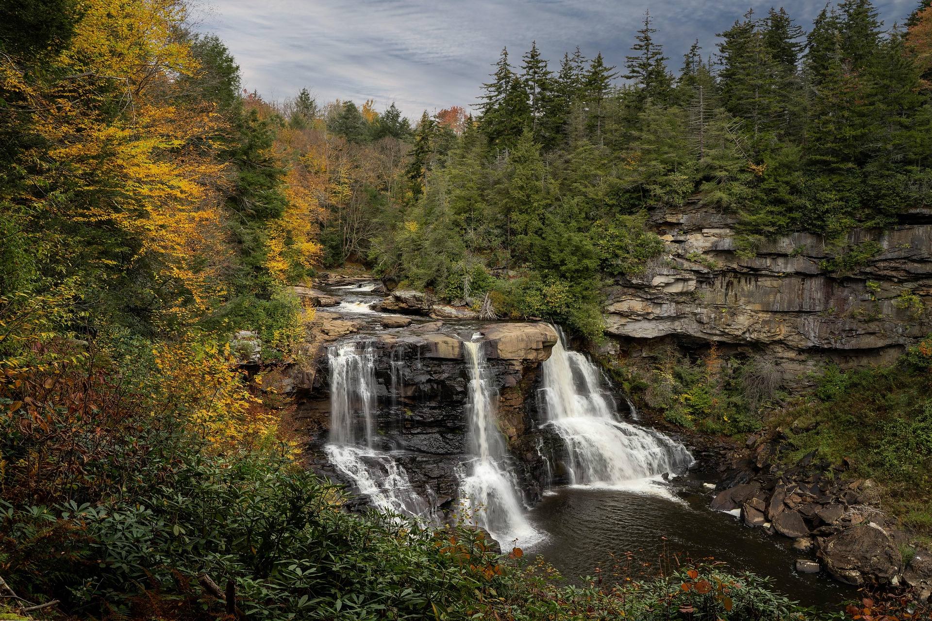
The falls that name the canyon are upstream of the trail, in Blackwater Falls State Park off WV 32 at Davis, and most people combine the two. The park is built around a fifty-seven-foot falls where the Blackwater River drops into an eight-mile canyon, its water stained amber by hemlock and spruce tannins. The boardwalk to the observation deck beside the falls is a quarter of a mile with more than two hundred steps down, and the steps rather than the distance are what people underestimate. The Gentle Trail covers the same quarter mile paved, to a deck overlooking the falls, and is the route for anyone who cannot manage stairs.
The park keeps twenty-one trails in all, and the short ones do most of the work. Lindy Point is three tenths of a mile, rated moderate to difficult, out to a rock outcrop the park puts at three thousand feet, and it produces the most photographed sunset in West Virginia. The Elakala Trail is half a mile, rated moderate, crossing a bridge directly above Elakala Falls five minutes from the lodge, and it gets overlooked constantly. Pendleton Point Overlook, at the end of the park road past the lodge, gives the deepest and widest view of the canyon and asks for no walking at all.
A few of the park trails connect outward rather than down to the water. River Road Trail is 1.56 miles of easy walking on an old railroad grade, linking the park directly to the town of Davis with fishing along the way. The Davis Trail is a quarter mile, rated moderate, and runs out of the park into the Monongahela National Forest network. Pace Point Trail is seven tenths of a mile, moderate, to an overlook above the North Fork. None of these are long, and all of them are steeper than the canyon grade, which is the difference between rim trails and railroad beds.
October, and the rest of the year
October is when the canyon fills up, and for good reason: the hardwood on these slopes turns while the hemlock and spruce stay dark, and a gravel grade puts you inside that rather than looking at it from a pull-off. If Lindy Point is on the plan, arrive well before sunset. The last stretch is boardwalk and rock, the platform is small, and in October there is a queue for the good corner of it. The canyon trail absorbs people far better; ten miles of grade spreads a crowd out in a way that a quarter-mile boardwalk cannot.
The rest of the year is quieter, and the Blackwater Canyon Trail is open through all of it. Winter turns the state park into a sledding hill, on the longest lift-served run in the region, served by a magic carpet and sold out on holiday weekends. The state park system also recommends the park for stargazing, which is unusual for somewhere with a lodge, cabins and a restaurant on site. Summer down in the canyon is cool and shaded, and the hemlock keeps the grade dark through the middle of the day, which is worth knowing in August.
Reach people planning this trip
Placement alongside guides for outfitters, guides, shops and lodging.
List your business hereQuestions
How long is the Blackwater Canyon Trail?
Do I need a shuttle?
What kind of bike do I need?
Is Douglas Falls worth the detour?
Can you hike or ski the trail instead of riding it?
What else is there at the top of the canyon?
Read next
 Destination · Potomac Highlands
Hiking Dolly Sods
A practical guide to hiking Dolly Sods Wilderness: the main trails, route options, why it is navigationally serious, and how to reach Bear Rocks.
9 min read Destination · Potomac Highlands
Things to Do in Davis and Thomas, West Virginia
A guide to Davis and Thomas, West Virginia: Blackwater Falls, Dolly Sods access, Canaan Valley skiing and two of the best small towns in Appalachia.
8 min read
Destination · Potomac Highlands
Blackwater Falls State Park
A complete guide to Blackwater Falls State Park: every waterfall and overlook, Lindy Point at sunset, the trails, lodging and the best season to visit.
8 min read · October